The Ocean Exploration Trust to Explore Deep-Sea Habitats in the Central and Eastern Pacific
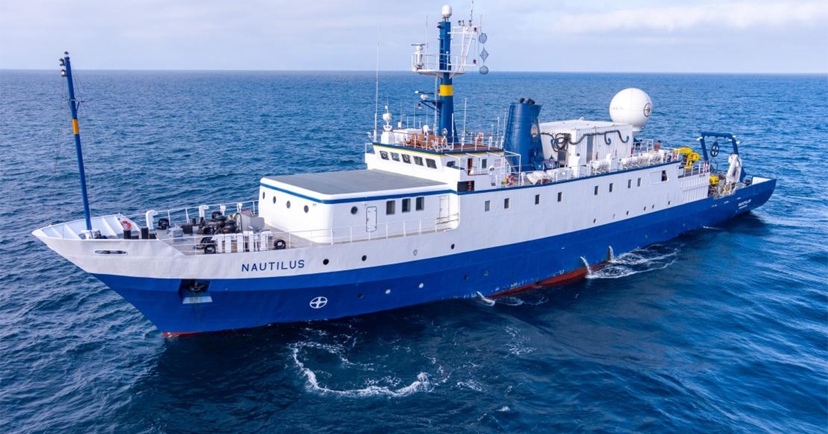
The Ocean Exploration Trust is excited to announce plans for the 2023 expedition season aboard Exploration Vessel (E/V) Nautilus. Ten separate expeditions will take place over the course of eight months at sea that, along with expedition partners, mapping and exploring deep-sea habitats in the Central and Eastern Pacific, as well as integrate several emerging technologies into at-sea operations.
From Hawaiʻi and the US Pacific Remote Islands up to British Columbia and back, E/V Nautilus will cover thousands of miles of open ocean. The 2023 Nautilus expeditions are sponsored by NOAA Ocean Exploration via the Ocean Exploration Cooperative Institute, with additional support from Ocean Networks Canada, Office of Naval Research, Bureau of Ocean Energy Management, and Defense POW/MIA Accounting Agency.
“We are excited to build on our longstanding partnerships and new collaborations for the 2023 Nautilus expedition as we visit incredible sites of geological, biological, and cultural significance across the Pacific,” says Allison Fundis, OET COO. “Our collaborators and partners are essential to our program as we work to operationalize new technologies that advance the field of ocean exploration, bring the deep sea to classrooms and homes around the globe, and most importantly as we work to conduct ocean exploration expeditions in more ethical and equitable ways.”
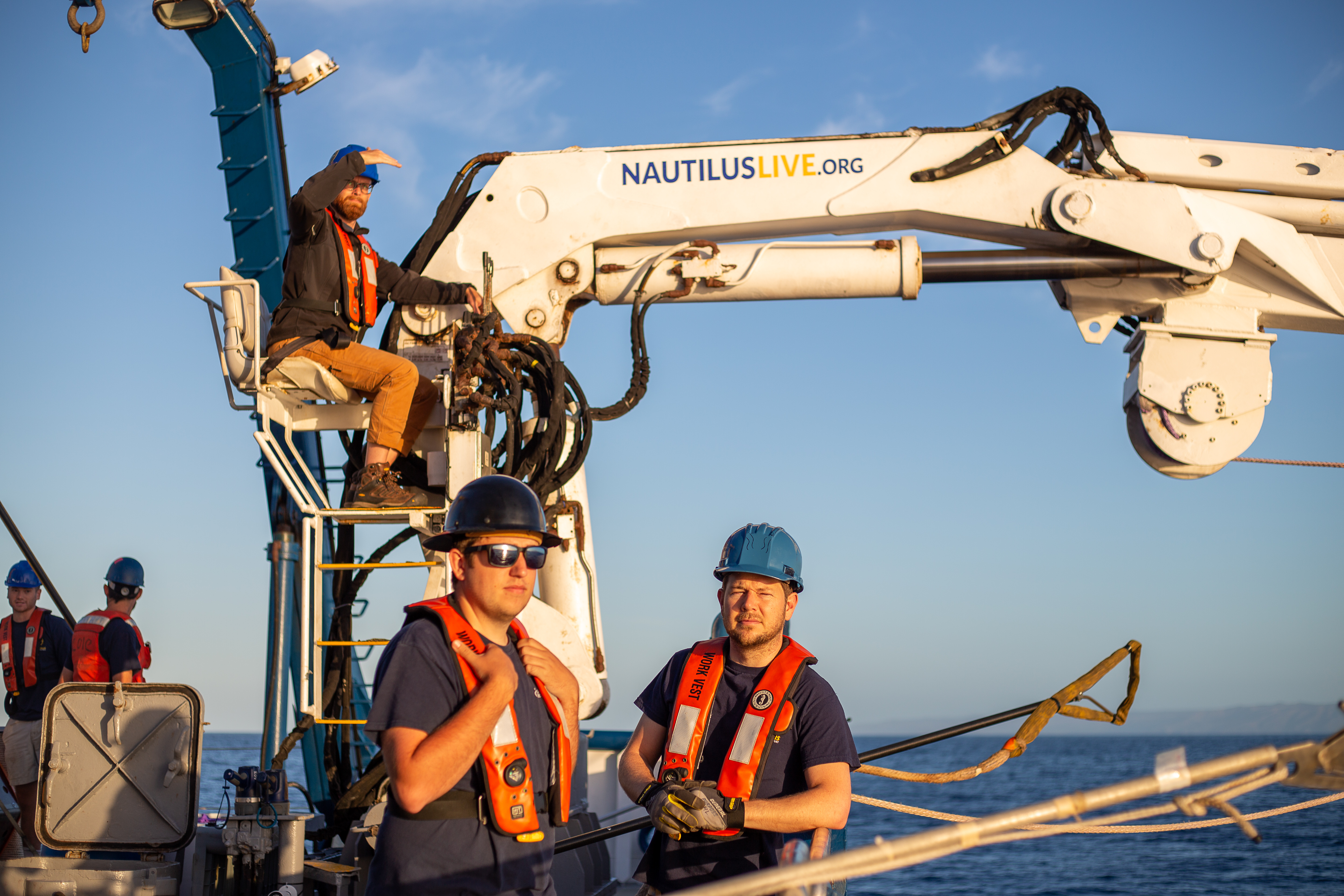
OET’s expertise in conducting telepresence-enabled expeditions offers opportunities for scientists, students, educators, and the public to participate remotely from shore. Scientists on shore can connect with personnel aboard E/V Nautilus via high-speed satellite-connected streaming and thereby help plan and execute science operations on the ship. Nautilus’s 2023 expeditions will focus on exploring the geological history of seamounts in the Pacific, deep-sea coral and sponge gardens, and marine protected areas, as well as integrating cutting-edge technologies into at-sea operations.
The 2023 E/V Nautilus expeditions are primarily supported by NOAA Ocean Exploration via the Ocean Exploration Cooperative Institute, a consortium that brings together the scientific expertise and ocean exploration technologies from the Ocean Exploration Trust, University of Rhode Island, Woods Hole Oceanographic Institution, University of New Hampshire, and the University of Southern Mississippi. By combining resources and expertise, the Ocean Exploration Cooperative Institute seeks to accelerate exploration of the approximately 3 billion acres of submerged US territory in support of NOAA mission goals and the US National Strategy on Ocean Mapping, Exploration, and Characterization (NOMEC). Expeditions will also support the Biden-Harris administration’s executive order on tackling the climate crisis (30x30), the GEBCO-Nippon Foundation’s Seabed2030 Program, and the United Nations’ Decade for Ocean Science for Sustainable Development.
“Most of our global ocean remains unmapped and unexplored, leaving significant knowledge gaps and hindering efforts to effectively manage our ocean resources,” says OET Chief Scientist Daniel Wagner. “Our expeditions will focus on collecting critical baseline information in unexplored areas, and thereby addressing the needs of the resource management and scientific community.”
From May to December 2023, E/V Nautilus expeditions will be made available to the public in real-time through live-streamed video on NautilusLive.org, a 24-hour portal bringing expeditions from the field to people on shore via telepresence technology. Viewers will be able to ask our at-sea team questions via the website and can also follow expeditions with behind-the-scenes updates on social media. The team of STEM professionals will also connect directly to classrooms via free educational Q&A interactions from the onboard broadcast studio. An ongoing series of live events on social media will also highlight expedition overviews and STEM career features. Additionally, OET offers 100+ free STEAM education resources for K-12 learners in English and Spanish, including national-standard aligned activities, engineering design challenges, and creative projects for learners in the classroom or at home.
As E/V Nautilus works in the Pacific, we acknowledge the indigenous and local communities of Oceania — including those known as Polynesians, Melanesians, Micronesians, Papuans, and other Pasifika peoples — who have stewarded through generations the ocean, seas, coastlines, and lands of what is known as the Pacific Ocean. We honor and respect the enduring deep relations and interconnections that exist between these peoples, the ocean, and the environment. Ocean Exploration Trust is committed to building connections with local communities in expedition regions through co-developing expedition plans, making data publicly accessible, and coordinating outreach with schools and community groups, and welcomes collaborative partnership inquiries at info@oet.org.
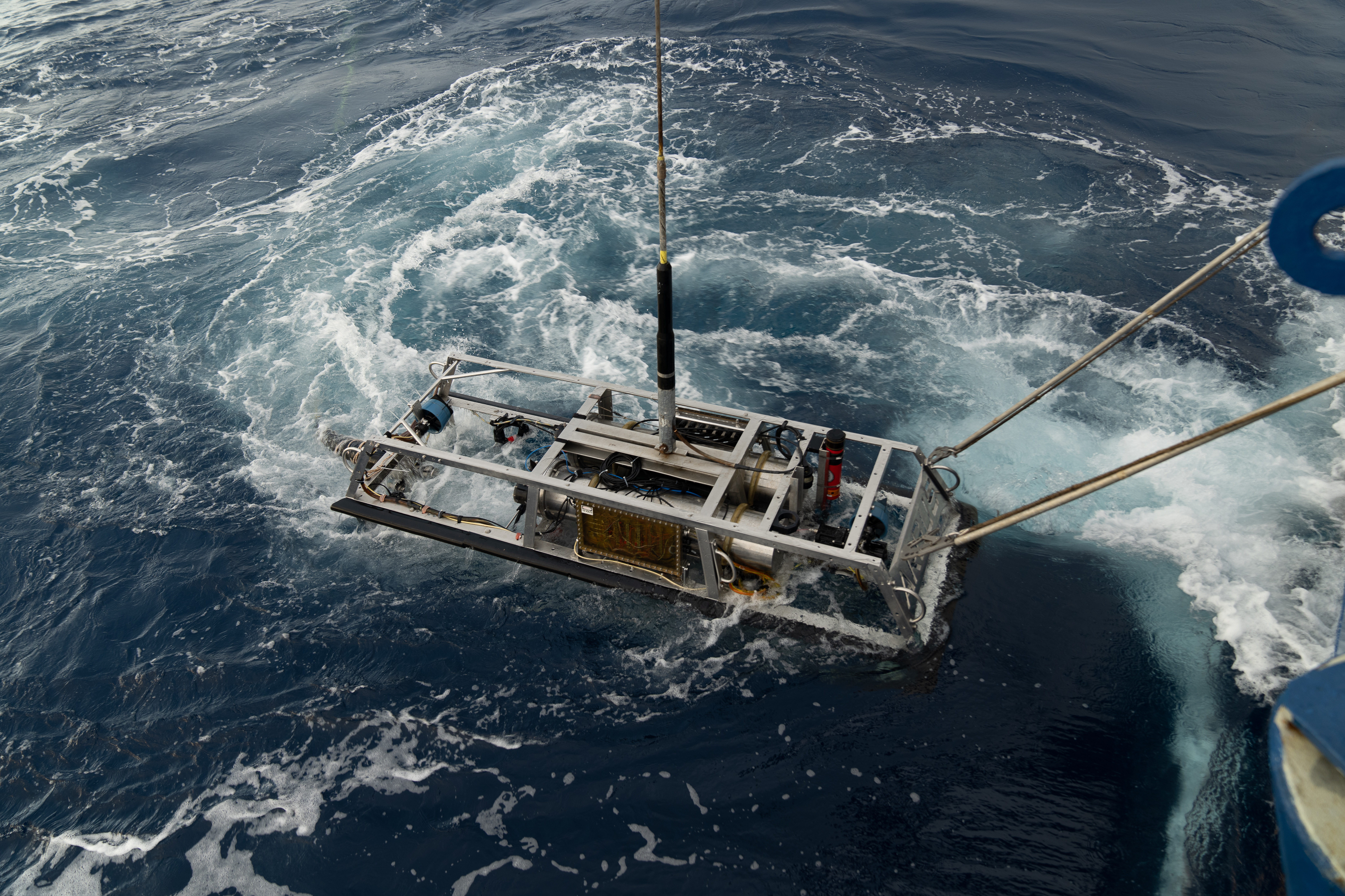
Expeditions are planned and executed around priorities of the science and resource management community to close knowledge gaps. Mapping and ROV operations will primarily be conducted in unexplored areas, thus contributing directly to the US National Strategy for Ocean Mapping, Exploration, and Characterization, Seabed 2030, and the UN Decade of Ocean Science for Sustainable Development. Integrating several autonomous vehicles onto E/V Nautilus will help advance national and international priorities for multi-vehicle ocean exploration.
2023 Expedition Summaries
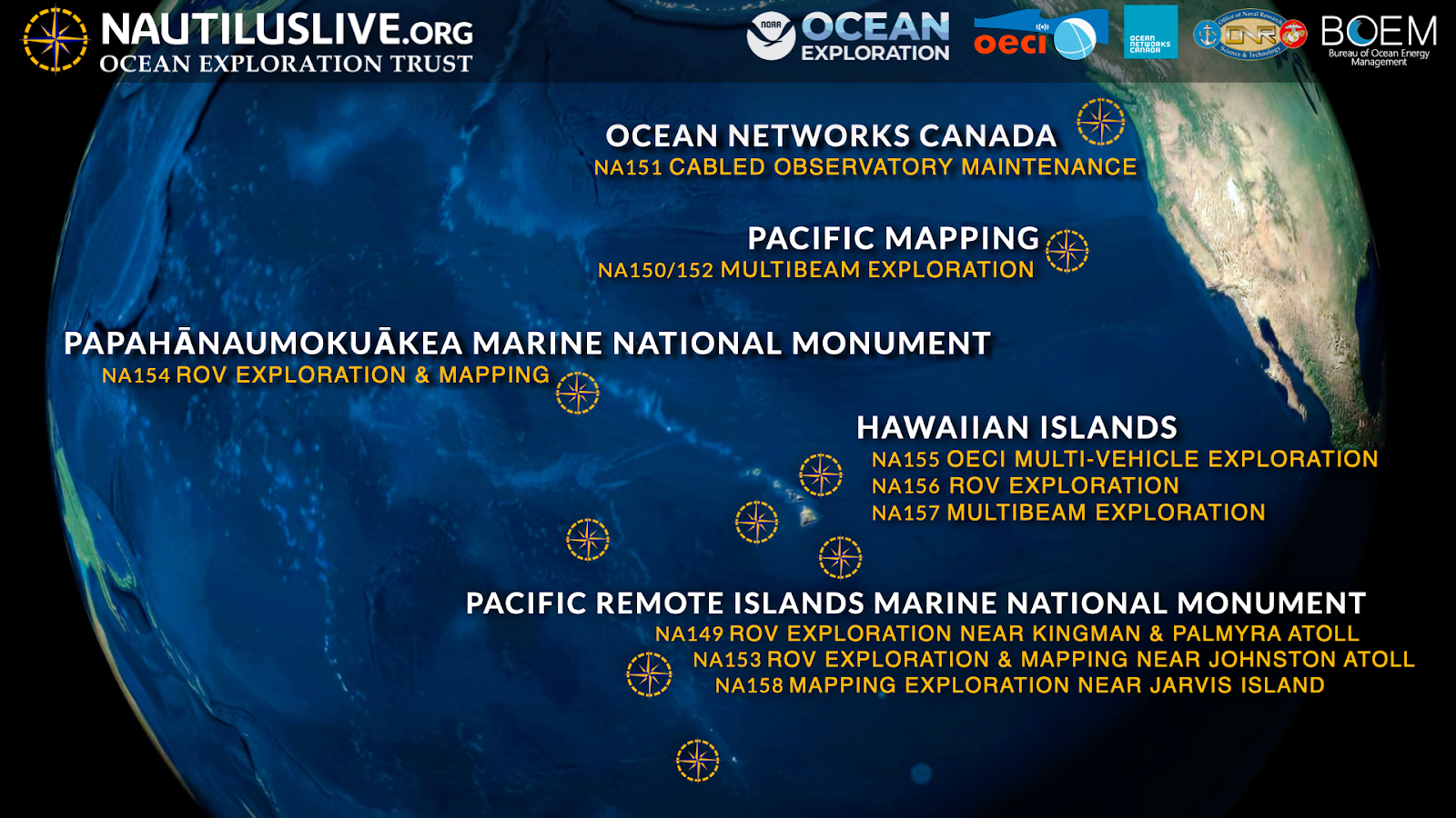
Exploring Deep Sea Habitats Near Kingman Reef & Palmyra Atoll | May 16 - June 14, 2023
This 29-day telepresence-enabled expedition will start and end in Honolulu and utilize the deep-water mapping and ROV capabilities of E/V Nautilus to explore the deep-sea geology and biology in US waters surrounding Kingman Reef and Palmyra Atoll. This will include the first-time integration of Impossible Sensing’s Raman Spectrometer (aka Laser Divebot) into E/V Nautilus ROV operations, which will collect high-fidelity chemical composition data on materials, including rocks, sediments, and biological samples, without having to collect physical samples.
Mid-Pacific Mapping Northbound | June 16 - June 25, 2023
This expedition is a seafloor mapping transit to bring the E/V Nautilus from Hawaiʻi to British Columbia. The transit route will be planned to fill gaps in seabed mapping and thereby support priorities of Seabed 2030 and the US National Strategy for Mapping, Exploration, and Characterization. This 9-day seafloor mapping expedition will start in Honolulu and end in Sidney (British Columbia) and utilize the deep-water mapping capabilities of E/V Nautilus to map previously uncharted seafloor during the transit route.
Ocean Networks Canada Maintenance and Exploration | June 26 - July 18, 2023
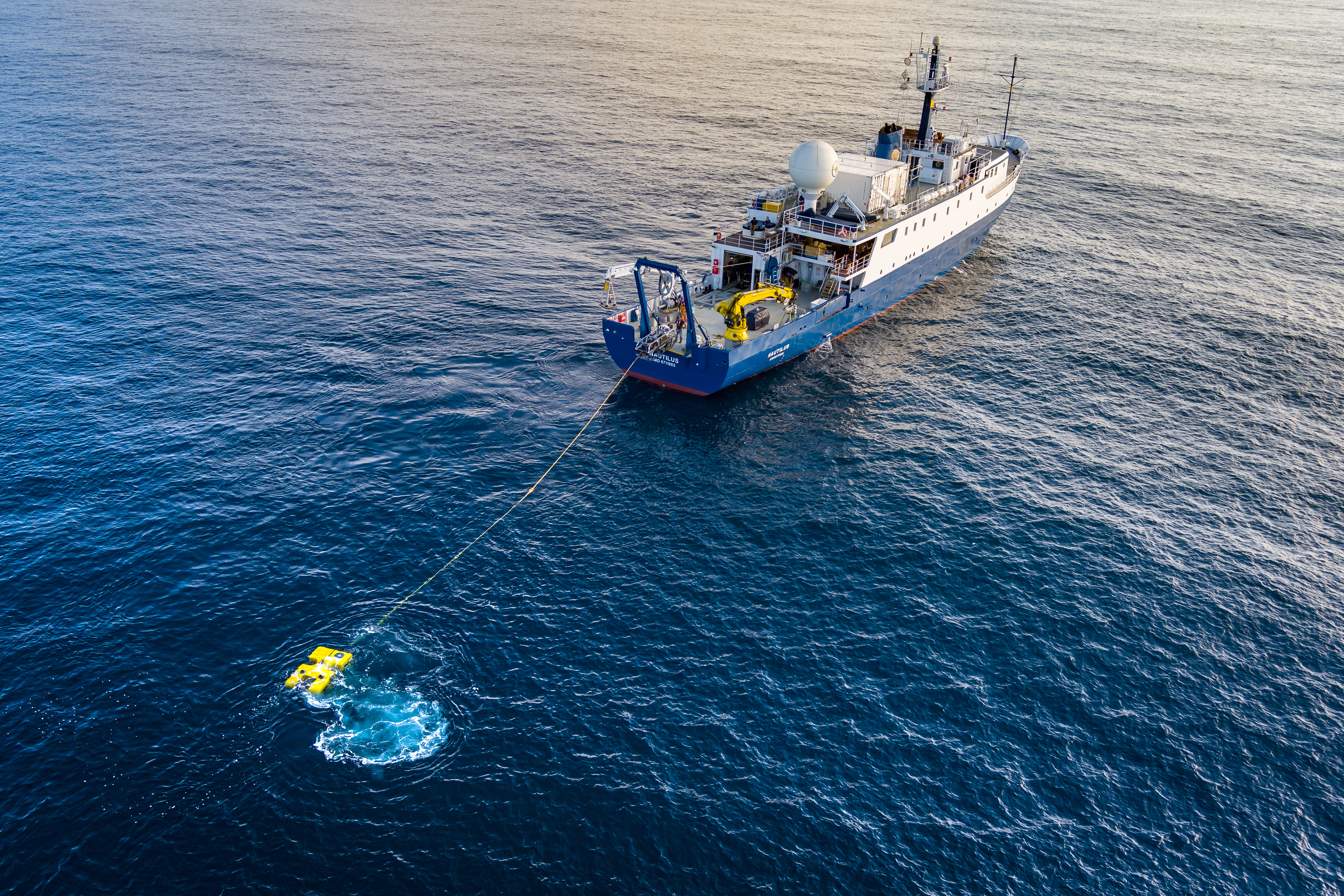
The main objective of this expedition which starts and ends in Sidney (British Columbia), is to provide maintenance and support of Ocean Networks Canada’s cabled observatory off the west coast of Canada. The cabled observatory consists of an 800-kilometer loop of fiber optic cable that connects various instruments, thereby providing high-resolution temporal observations not afforded by traditional ship-based exploration. During this 22-day expedition, E/V Nautilus will deploy and recover various sensors and instruments, as well as conduct seafloor mapping and ROV surveys. This expedition marks the seventh year of the partnership between Ocean Networks Canada and OET.
Mid-Pacific Mapping Southbound | July 19 - July 29, 2023
This expedition is a seafloor mapping transit to bring the E/V Nautilus from British Columbia back to the Central Pacific, where the ship will operate for the remainder of the 2023 field season. The transit route will be planned to fill gaps in seabed mapping and thereby support priorities of Seabed 2030 and the US National Strategy for Mapping, Exploration, and Characterization. This 12-day seafloor mapping expedition will start in Sidney (British Columbia) and end in Honolulu and utilize the deep-water mapping capabilities of E/V Nautilus to map previously uncharted seafloor. Additionally, the expedition will include a mapping calibration exercise for data comparisons amongst different oceanographic vessels.
Deep Sea Biodiversity & Ancient Seamount Exploration near Johnston Atoll | August 2 - 29, 2023
While recent expeditions of PRIMNM have increased our baseline knowledge of the deep-water resources of PRIMNM, large areas remain completely unexplored, particularly towards the northern boundary of the Johnston Unit of PRIMNM. This 27-day expedition will start and end in Honolulu and utilize ROVs and mapping capabilities of E/V Nautilus and USV DriX to survey previously unexplored deep-sea (>200 meters) habitats in the US EEZ surrounding Johnston Atoll. By operating DriX independently from E/V Nautilus for up to several days at a time, this expedition will aim to significantly increase the pace of mapping operations.
Ala ʻAumoana Kai Uli in Papahānaumokuākea Marine National Monument | Sept 1 - 28, 2023
We once again voyage to the Papahānaumokuākea Marine National Monument (PMNM) to explore unseen deep-sea habitats using our ROV technology. Further exploration in these areas is urgently needed to address the management and science needs of the region, including a better understanding of the deep-water natural and cultural resources of PMNM, biogeographic patterns of species distributions, and the geological context of the region. This 27-day expedition will start and end in Honolulu and utilize the ROV and mapping capabilities of E/V Nautilus to survey previously unexplored deep-sea (>200 meters) habitats of PMNM, focusing on areas towards the northwestern extent of the Monument.
OECI Multi-Vehicle Exploration | October 1 - 19, 2023
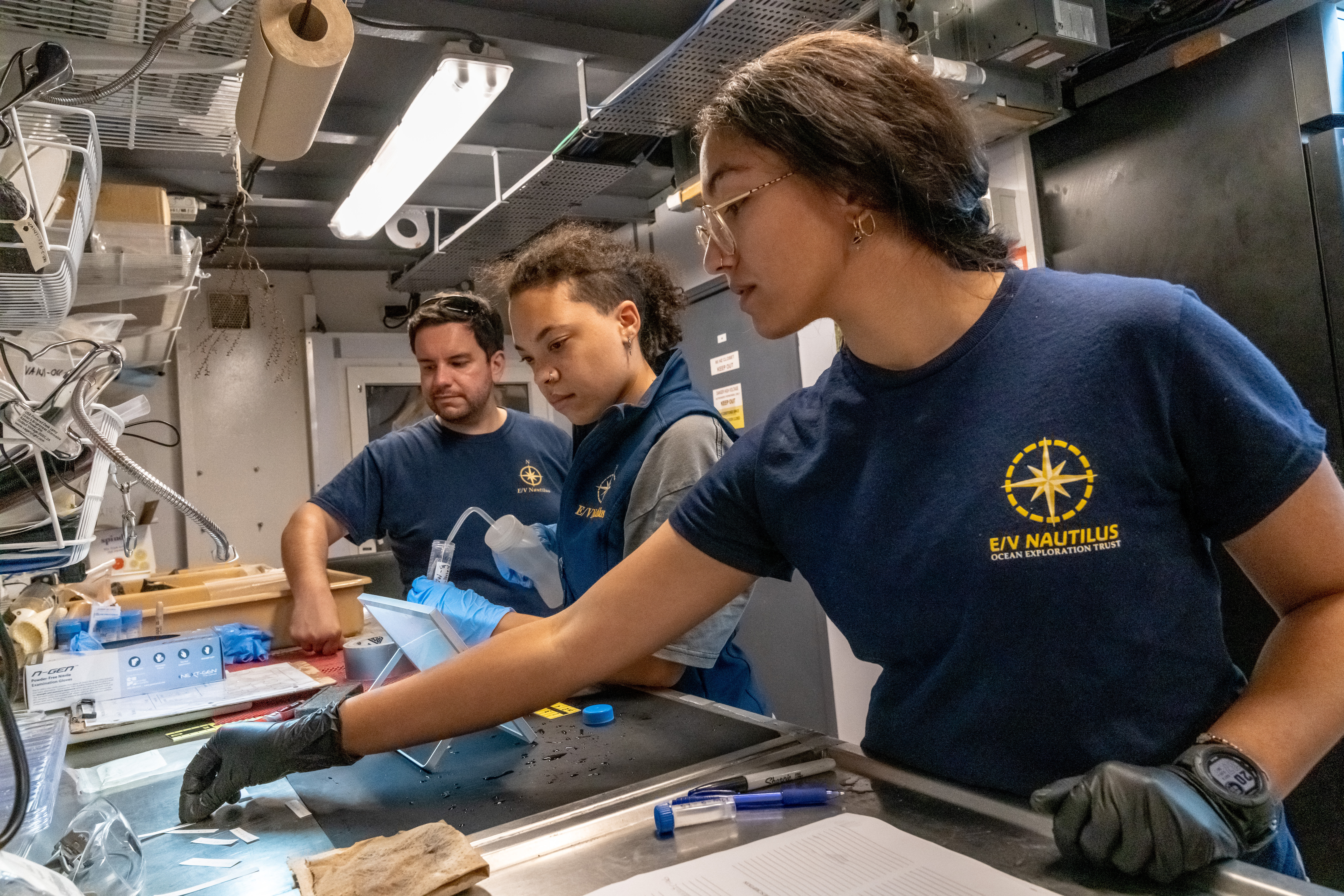
Over the last three years, the Ocean Exploration Cooperative Institute has been testing the integration of multiple exploration technologies via annual technology demonstration expeditions aboard E/V Nautilus. This third iteration of technology demonstrations will transition these systems from prototypes and demonstrations to operational tools for ocean exploration. This 18-day telepresence-enabled expedition will include deployments of USV DriX, AUV Mesobot, and Deep Autonomous Profiler, each of which offers complementary capabilities to explore the ocean from the deep seafloor through the entire water column. The expedition will start and end in Honolulu and explore the seafloor and overlaying water column around the Geologists Seamount chain located south of the Main Hawaiian Islands.
Ocean Exploration Through Advanced Imaging | October 22 - November 5, 2023
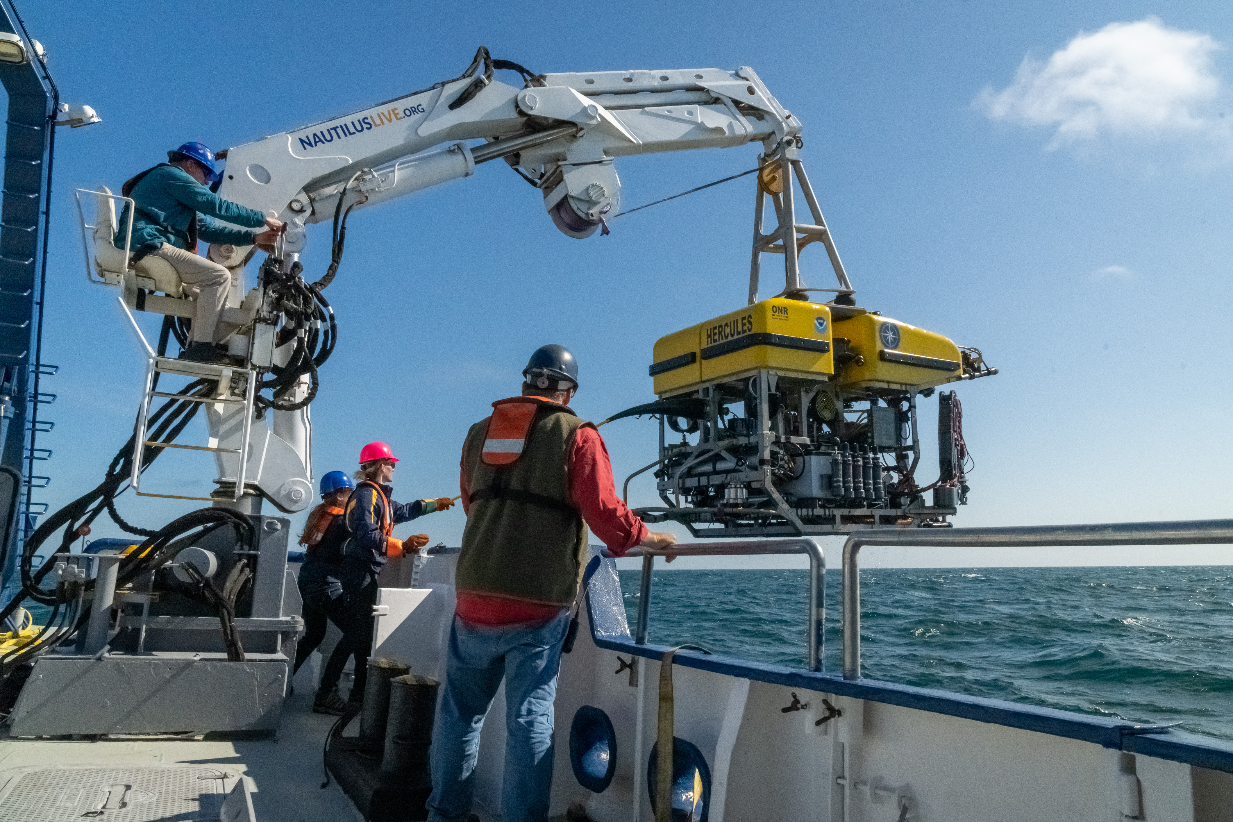
In October, we return to ROV dives continuing our work to advance technology use in the deep sea. Experimenting with deploying a new camera technology, we will explore using a new wide-field camera array on ROV Hercules to capture three-dimensional stereoscopic imagery from the seabed. One of the modern challenges of ocean exploration is processing and reviewing the high volume of data generated from each expedition. On this voyage, we will also test a Rapid Automatic Image Categorization artificial intelligence software to quickly annotate video in near real-time.
Hawaiʻi Mapping | November 7 - 17, 2023
This 10-day expedition will start and end in Honolulu and utilize the deep-water mapping capabilities of E/V Nautilus to survey previously unmapped seafloor in the US EEZ south of the Main Hawaiian Islands. In addition to deep-sea mapping operations, the expedition will also include deployments of the Deep Autonomous Profiler to collect visual, environmental, and eDNA data to enable baseline characterizations of the deep-water environments of this region. This expedition will also include opportunities for student interns to obtain at-sea training, including mapping and other marine science operations.
Jarvis Island Mapping | November 20 - December 20, 2023
The seafloor surrounding Jarvis Island includes some of the most poorly mapped areas under US jurisdiction. Mapping these areas is urgently needed to support management and science priorities of the Pacific Remote Islands Marine National Monument (PRIMNM), including follow-on surveys to better understand the natural and cultural resources of the Monument. This 30-day expedition will start in Honolulu and utilize the deep-water mapping capabilities of E/V Nautilus to survey previously unmapped seafloor in the Jarvis Unit of PRIMNM. In addition to deep-sea mapping operations, the expedition will also include the participation of several student interns, who will obtain at-sea training in mapping operations.

