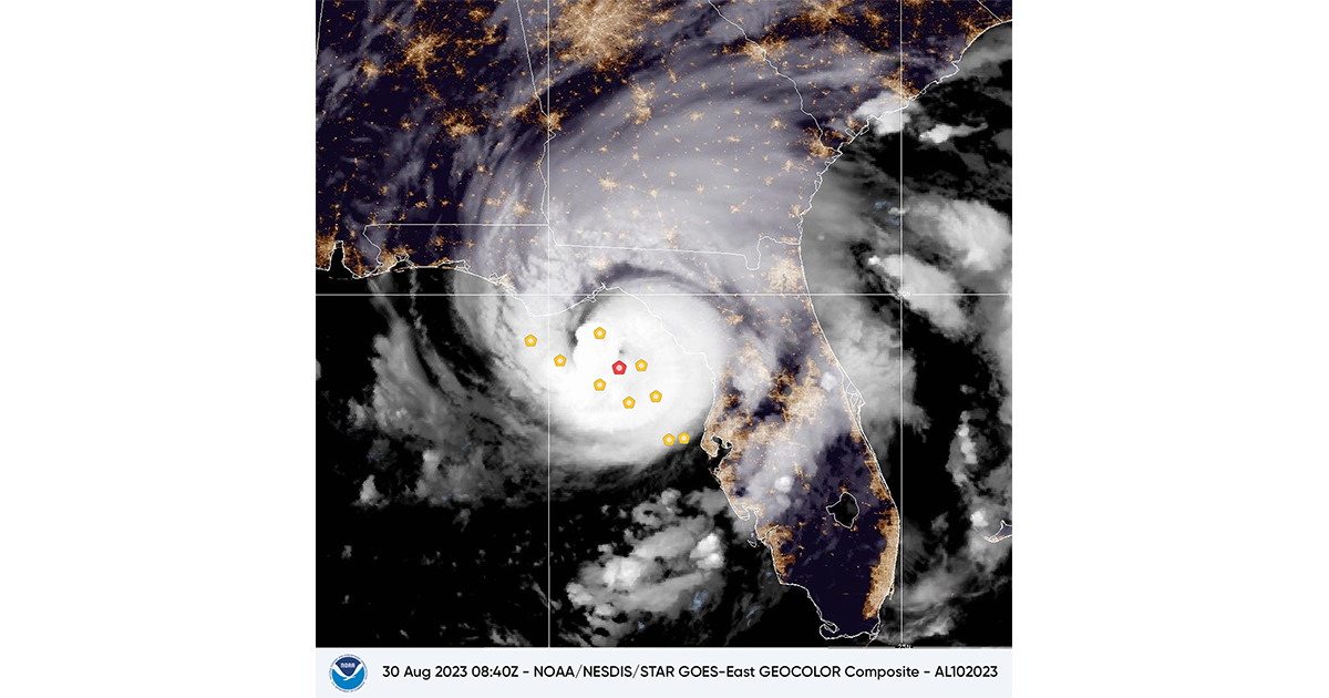
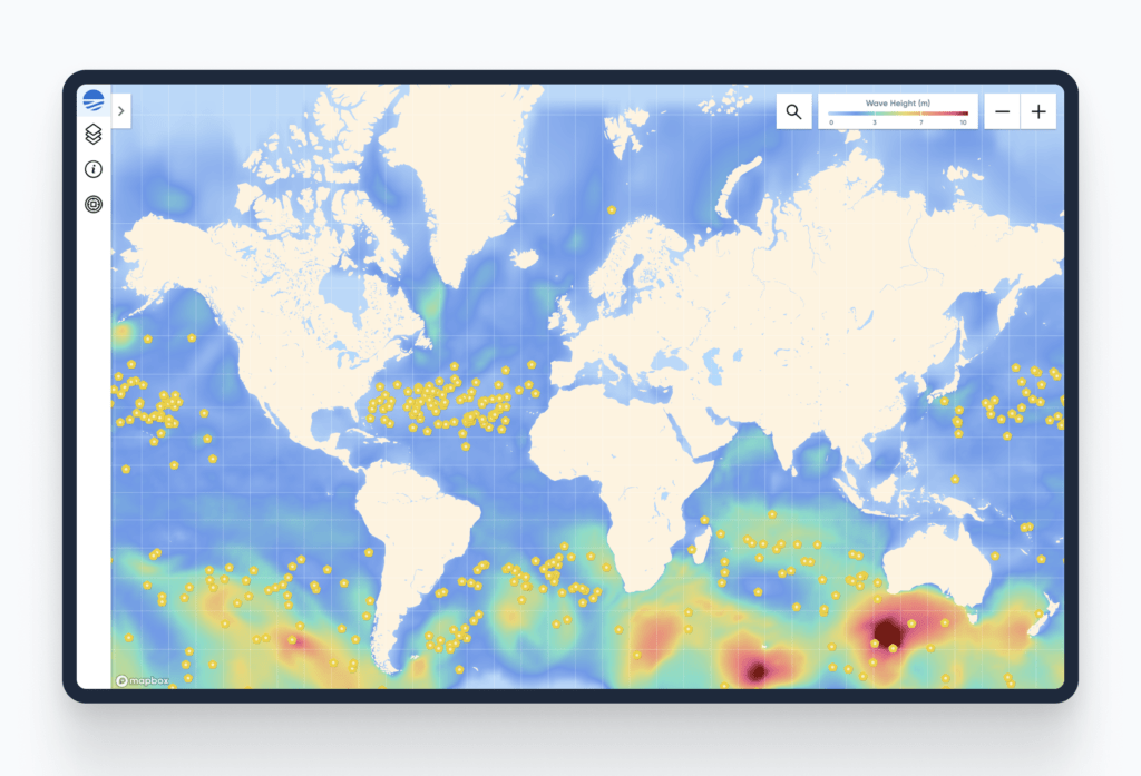
The NHC uses direct observations made by Sofar’s global network of ocean sensors to validate models, verify current conditions, and make short-term adjustments to wave forecasts. Sofar’s sensors, known as Spotter buoys, collect and transmit real-time wave, wind, sea surface temperature, and atmospheric pressure data at scale. This includes observations made by Spotters airdropped in the path of hurricanes 24–48 hours before landfall, which provide rare insight into the chaotic ocean conditions generated by major storms.
Sofar’s data is available via the National Weather Service’s (NWS) Advanced Weather Interactive Processing System (AWIPS), the core platform used by the NHC to prepare and issue weather forecasts and warnings.
“Real-time data is essential for reducing weather and climate uncertainty and forecasting extreme storms,” said Tim Janssen, Co-Founder and CEO of Sofar. “Our global network of ocean sensors makes direct observations at a planetary scale. We are excited to supply the NHC with the ground truth data it needs to support early warning systems.”
Curtis Marshall, NWS Program Manager for the NMP, added, “The National Weather Service is pleased to partner with Sofar, KBR, and Synoptic to obtain valuable observations on the global ocean. Wind, wave, and temperature data from these buoys could be useful to weather forecasters, as exemplified by their utility to the operations of the National Hurricane Center and the Ocean Prediction Center.”
As hurricane season intensifies in the Atlantic, the NHC is leveraging Sofar’s data in real-time operations to better understand the extreme conditions generated by storms, particularly in the open ocean.
“These historically scarce data points help improve critical early warning systems for hurricanes and complement the observations made by satellites and other sources,” said Isabel Houghton, Principal Research Scientist at Sofar.
NWS’ Total Operational Weather Readiness—Satellites (TOWR-S) team, prime contractor KBR, and Synoptic drove the integration of Sofar’s data into AWIPS to make the observations accessible to forecasters.
“Synoptic is proud to facilitate the integration of Sofar’s data into the National Weather Service and National Hurricane Center through the NMP,” said Elizabeth Wilson, Director of Weather Programs at Synoptic. “This collaboration not only enhances situational awareness during extreme weather events but also fills crucial observational gaps in the open ocean where traditional data sources are limited. By ensuring that real-time ocean data is accessible to forecasters, we are helping to improve the accuracy of forecasts and ultimately contributing to better preparedness and response efforts during hurricane season.”