
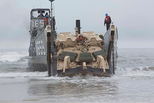
Amphibious operations are among the most high-risk maneuvers in modern warfare. Historically, the “last tactical mile”—the volatile transition from sea to shore—has been a dangerous blind spot.
To determine if a beach is safe, Marines have traditionally relied on manual reconnaissance, sending divers into harm’s way to measure depths, currents, wave heights, and obstacles.
The future of littoral maneuver isn’t just about getting to the beach—it’s about knowing what beach provides tactical supremacy—making data driven decisions that minimize risk to our warfighters at a pace that always keeps adversaries on the back foot. Real-time awareness of the surface and subsurface environment before marines even launch from their vessel is critical.
Marines are transforming the operational parameters of these missions using the JaiaBot system to replace human risk with autonomous precision and redefining the speed and safety of littoral maneuvers.
The Critical Challenge
Amphibious Landings in Contested Waters Present Inherent Threats
In an amphibious assault, mission success hinges on pinpoint accurate surf-zone surveying. Before a single landing craft or amphibious combat vehicle (ACV) hits the surf, commanders must answer three critical questions:
Bathymetry
Is the water deep enough for the hulls, or will they beach on a sandbar 50 yards out?
Currents
Are rip currents too strong or moving in the wrong direction for safe maneuvering?
Obstacles
Traditionally, gathering this data put our troops at considerable risk in small boats and in the water performing subjective measurements that took hours or days. In modern conflict, that delay dramatically increases the risk to our Marines.
Data Intel In The Surf Zone
US Marines Can Now Access Real-Time Data in Nearshore Environments
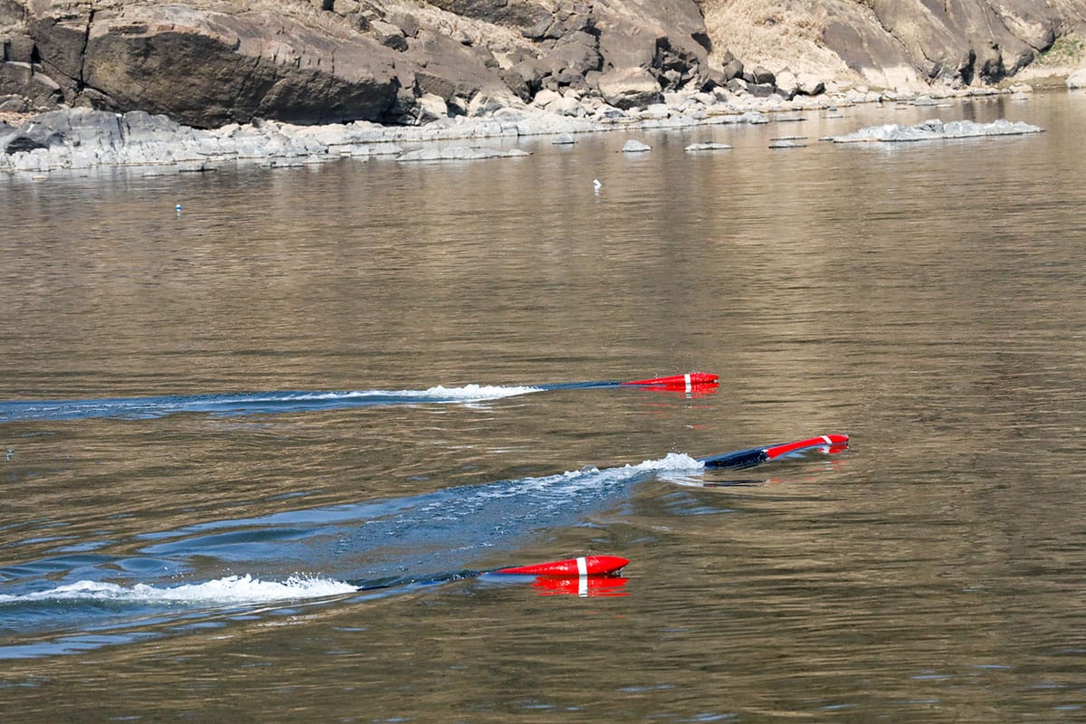
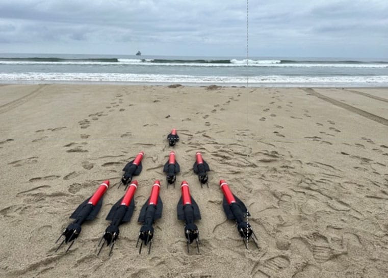
JaiaBots are micro-sized, ultra-portable, low-cost autonomous underwater vehicles (AUVs) designed to work in multi-vehicle pods (swarms). Their mission is to collect Tactical Oceanographic (TAC-O) data in the surf zone, wet gap locations, and nearshore environments with a speed and scientific precision that human swimmers simply cannot match.
Operating in coordinated pods, JaiaBot-HYDRO and JaiaBot-PAM systems deliver real-time intelligence:
-
3D Bathymetric MapsUser-defined spatial resolution for precise bottom-mapping.
-
Wave CharacterizationReal-time height and period data.
-
Current VectorsImmediate identification of rip and littoral current strength.
-
Bottom TypeAssessment of landing conditions (hard vs. soft).
-
CTDOptional sensor suite to provide CTD profiles.
-
SoundscapeAcoustic baselines to support sonar operations.
Deployment
Rugged, Flexible, Stealthy
A primary advantage of the JaiaBot platform is its multidomain launch capability. Marines can easily deploy these bots at the point of need without exposing personnel to potentially dangerous hazards or risk of detection by adversaries:
-
ShorelinesEasy to launch, even in high surf conditions like 12-foot Pacific waves.
-
Surface CraftLaunched from RHIBs, CRRCs, or unmanned surface vessels (USVs).
-
AircraftDropped from helicopters (up to 25 feet) or Unmanned Aircraft Systems (UAS).
How it Works
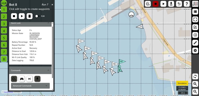
The Autonomous Reconnaissance Mission
US Marines ready and deploy a pod of JaiaBots, which transit at 5–7 knots, covering the target beach landing site accurately and efficiently. Engineered to operate autonomously in the surf zone, these pods have been successfully deployed to support littoral maneuver operations in marine conditions up to Sea State 5 and 8–12-foot breakers.
Plan
Deploy
JaiaBots are launched to execute the mission and transit on the surface to designated data collection points.
Bathymetry
Surface
Upon resurfacing, the bot drifts to measure wave height and period before moving to the next data collection point.
Data
Decision
Case Study
Rapid Littoral Survey Evaluation in the Pacific by US Marine Corps
-
ExecutionLaunched from a small boat outside the surf zone, the bots reached their grid lines in minutes.
-
ResultWithin 45 minutes, the command team had a full digital picture of the approach. They identified a safe corridor, flagged a dangerous nearshore trough, and located two secondary landing sites.
-
ImpactA survey that traditionally requires a multi-hour, high-risk swimmer mission was completed in under an hour without putting a single Marine in the water.
Integration
Built for the Warfighter
To date, over 120 Marines from reconnaissance, logistics, and infantry units have trained with the system. A foundational goal for Jaia Robotics is simplicity. The JaiaBot system requires minimal training—typically just two days for a Marine to master mission planning, deployment, and recovery. Marines are rapidly adopting this new autonomous approach to surf zone observations.
Autonomy is the ultimate force multiplier. One Marine can now manage a pod of bots that performs the work of an entire Recon platoon. Keeping warfighters out of harm’s way and letting robots do the work as much as possible just makes sense.
-
Data-Driven SafetyReplaces subjective human estimates with repeatable, georeferenced data.
-
Pinpoint PrecisionSandbars, currents, and underwater obstacles are identified, preventing the grounding of expensive landing craft.
-
Low SignatureMicro-sized AUVs maintain the element of surprise with almost undetectable electronic and physical footprints.
-
Autonomy is the Force MultiplierReduces the time to characterize a surf zone from days to minutes to ensure mission readiness.
-
EmpowermentEnabling Marines who are not Recon-Diver trained to carry out these missions increases the ability to do more missions.
As the US Navy and Marine Corps move toward Expeditionary Advanced Base Operations (EABO), the ability to rapidly characterize the surf zone clandestinely can be the difference between warfighters making it home or not. By replacing human risk with low-cost autonomous precision, JaiaBots are ensuring the “Blue-Green” team stays one step ahead of adversaries in notoriously unpredictable environments at critical moments.
Learn more about successful Amphibious Landing Missions at www.jaia.tech/defense.