
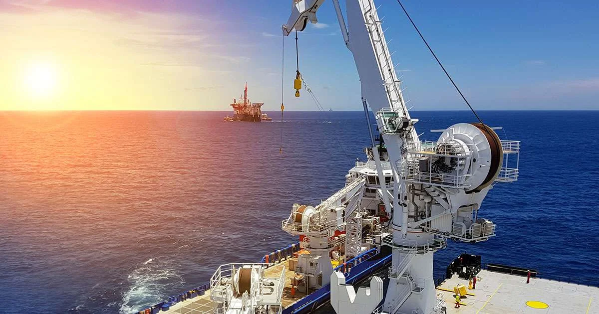
These situations may look unrelated, but they can stem from the same weakness: a decision is made without a reliable picture of what the ocean is actually doing at the vessel location.
Offshore operations are becoming increasingly connected. Vessels carry more sensors, platforms generate more data, and shore teams have greater access to live operational information. Decision-support systems are also becoming more sophisticated, while automation is moving further into daily operations.
In March 2026, the International Maritime Organization’s Facilitation Committee approved the IMO Strategy on Maritime Digitalization. It aims to establish digitalization as an overarching IMO policy, applied across the organization’s bodies and processes, before being submitted to the IMO Assembly for adoption in 2027.
The direction is clear. Maritime operations are moving towards more automated and data-driven decision-making. But more software does not automatically mean better decisions. Digitalization only creates value when the data beneath it is timely, relevant and trustworthy.
The Data Challenge Behind Automation
Automation does not eliminate uncertainty. It can process information faster and apply rules more consistently, but it cannot correct input data that fails to reflect the conditions at the vessel location.
Metocean forecasts remain essential for planning. However, a forecast describes expected conditions across a particular area and period. But the motion experienced by an individual vessel is also influenced by its precise location, heading, loading condition, design and response to the prevailing waves.
The forecast may therefore remain within operational limits while the crew on deck experiences something different.
Consider a lifting operation. The weather forecast looks acceptable, the project is behind schedule, and the next suitable weather window may not arrive for another day. The operation begins, but the vessel starts responding more strongly than expected.
The team must decide whether to stop and accept the delay or continue because the forecast still indicates acceptable conditions.
This is where incomplete data becomes an operational risk. The same challenge applies to walk-to-work transfers, ROV launches, cargo handling and subsea work.
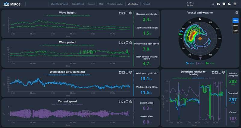
Real-time, in-situ measurements change the basis of the discussion. Instead of asking only what a model says should be happening, the team can also see what is being measured at the vessel.
The Operational Consequences
The consequences extend beyond an inaccurate recommendation. They can affect safety, asset integrity, downtime and confidence in the decision itself.
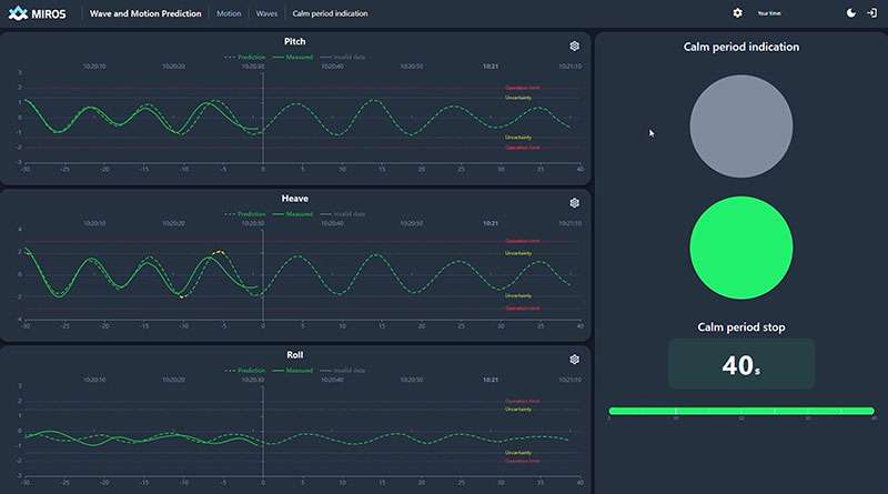
For weather-sensitive operations, time is an important safety margin. Short-term vessel-motion predictions based on measured sea state and actual vessel response may indicate how the vessel is likely to move over the next few minutes.
This is not a reliable view several hours ahead. It is a much shorter operational horizon. Yet even a two-minute indication can help teams identify suitable operating slots, prepare for an approaching motion peak and make better-informed start, stop or continue decisions without changing established safety limits.
Incomplete data can also affect equipment. Moorings, thrusters, cranes, gangways and winches are exposed to the actual sea state, not the forecasted one. If the loads differ from those assumed during planning, wear may increase and maintenance may be required earlier than expected.
There is also a cost associated with unnecessary caution. Weather downtime is not caused only by poor conditions; it can also result from limited confidence in the available information.
A vessel may remain on standby because nobody is certain whether conditions are acceptable. In another case, an operation may continue too long because the forecast still looks favorable. Both outcomes carry cost and risk.
A Shared Picture of Actual Conditions
Operational friction often appears when stakeholders work from different sources. The vessel team may rely on onboard observations, the client may look at a forecast and the project team may use another data service.
When the numbers do not align, the discussion can become a negotiation over which source to trust rather than a clear decision about what to do.
A shared record of measured sea state and vessel response gives the vessel, client and shore team a common operational picture. It does not remove professional judgement, but it allows that judgement to be applied to the same set of facts.
Closing the Gap Between Forecast & Reality
Forecasts, real-time measurements and prediction tools serve different purposes.
Forecasts support planning. Measurements show what is happening now. Very short-term predictions can indicate what the vessel may experience next. The strongest decision basis comes from combining all three.
As automation expands across offshore operations, the quality of the underlying ocean data becomes more important, not less. An automated system can scale a decision process across a vessel, fleet or field. If that process is built on incomplete data, the same weakness is repeated consistently and at greater scale.
The technology required to measure real ocean conditions already exists. The remaining question is whether it will continue to be treated as an optional layer or become a baseline requirement for automated offshore decision-making.
If the industry wants to automate more decisions offshore, it should first ensure that its systems are working with the same ocean the crew is actually experiencing.