Geophysical and geotechnical site characterisation surveys, for example, are typically commissioned separately. However, this can lead to an additional administrative burden for the developer, overrunning projects and escalating costs, particularly if knowledge of the ground model is transferred inadequately and/or the necessary data integration happens late in the project.
There are significant advantages to a collaborative, integrated approach that combines geophysical and geotechnical surveys. Although geophysical results inform later geotechnical site investigations, considering the surveys together helps to better target geotechnical studies and ensure knowledge of the ground model and drill sites is transferred effectively.
More efficient surveys can help to deliver faster site assessments and, combined with the lower administrative burden from using a single interface, contact person, and contract can help to reduce costs. Effective knowledge transfer and improved ground models can better inform geotechnical site investigation locations for de-risked, cost-effective structure designs and, ultimately, better long-term project outcomes for a lower levelised cost of energy.
POOLING DEEP DOMAIN KNOWLEDGE
As a result of the pursuit of offshore renewable energy, reliable and competitively priced seabed site characterisation services are in high demand, with only a few large providers able to deliver combined geophysical and geotechnical services to meet offshore wind developers’ needs. Together, the Geo-services brands in Acteon’s Data and Robotics division provide another option and combine deep domain knowledge with the scale and reach to handle large offshore wind site characterisation contracts across the globe. All through a single point of contact, which eliminates the need to manage separate interfaces and contracts.
The BlueFloat Energy and Renantis Partnership is already taking advantage of an integrated geophysical and geotechnical survey for its Bellrock and Broadshore wind farms northeast of Aberdeen, Scotland, UK. In the USA, Acteon established a new base early in 2022 in Massachusetts, through its Geo-services brand TerraSond, to better support the Vineyard Wind 1 project and wider US offshore wind developments.
TECHNOLOGY IN THE FIELD
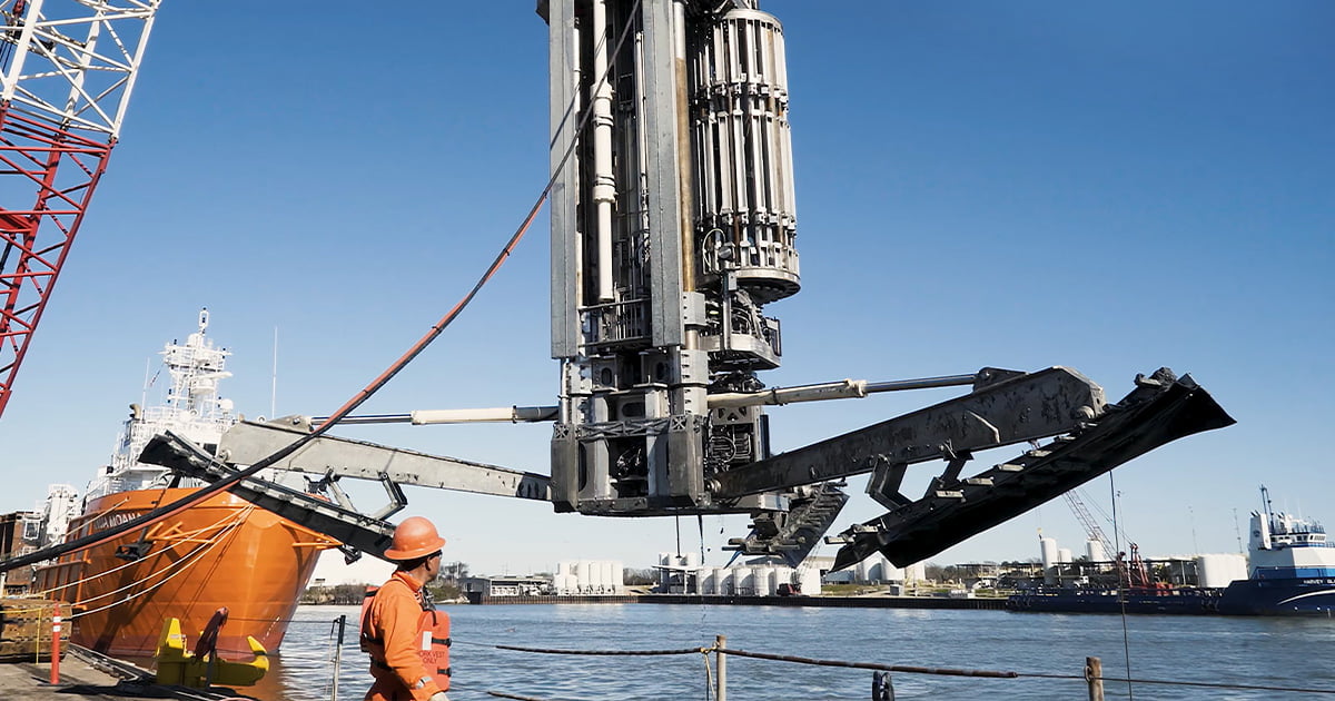
Technology also plays a critical role in delivering efficiency. For instance, TerraSond’s autonomous surface vessels routinely double geophysical survey coverage and halve the company’s carbon footprint. Also within Acteon’s portfolio, Benthic’s Portable Remotely Operated Drill (PROD) systems remove the need for costly drill ships and can achieve greater penetration depths than other seafloor systems; and UTEC’s iSite Subsea solution enables virtual survey data interrogation and comparison via a single secure cloud-based interface, remotely, 24/7 and without specialist software knowledge.
The integration of geophysical and geotechnical surveys, applied with deep domain knowledge and the latest innovative technologies, and combined with scale and global reach, has the potential to achieve efficiencies in the development of offshore wind in Europe, the USA and beyond.
This spotlight was originally featured in ON&T Magazine’s May 2023 issue. Click here to read more.