Historical observations have been conducted by divers navigating predefined transects to collect downward video recordings for manual review. The future of marine habitat monitoring will be driven by advancements in underwater optical imaging with data that is automatically analyzed and correlated with biological sensing data.
UNDERWATER OPTICAL SENSORS
Optical sensors can be deployed on autonomous underwater vehicles (AUVs) which excel in wide-area transect-based surveys and complemented with remotely operated vehicles (ROVs) for localized inspection in regions of limited water clarity. This combined approach can adapt to regional ocean conditions and scale to cover wider areas than conventional methods.
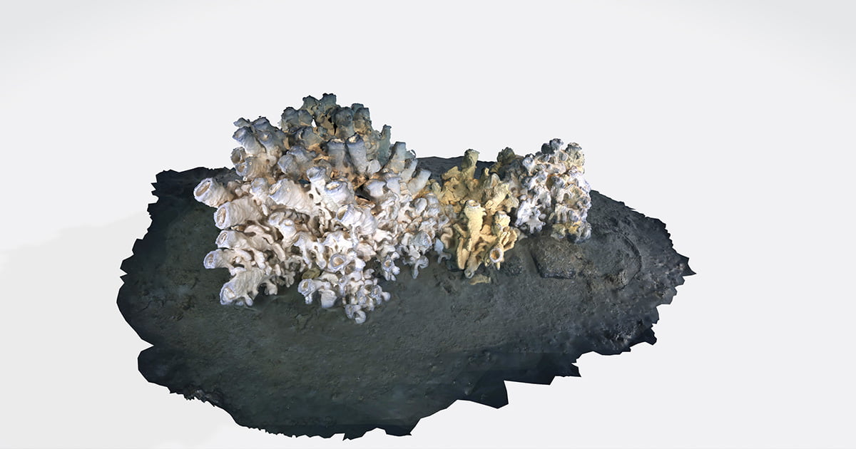
Two revolutionary technologies will make the concept of remote MPA monitoring a reality. First, the ability to rapidly generate accurate 3D models of localized habitats using calibrated cameras and powerful lighting systems. These high-resolution and color-corrected digital twins enable precise change detection between periodic surveys, and the ability to meticulously inspect the flora and fauna. These captivating reconstructions empower conservation efforts by better illuminating the fascinating ecosystems we need to protect.
The second transformation is using unsupervised machine learning for the automated statistical analysis of image datasets. Each MPA is unique, as are the scientific questions, a variability not well suited to conventional machine learning approaches that thrive on consistency. A powerful new approach, developed by Voyis in partnership with the University of Southampton, efficiently clusters and indexes immense image datasets to streamline data interpretation and dissemination, supporting automated tasks such as measuring species abundance and live versus dead coral ratios.
THE IMAGE PROJECT
The IMAGE project (Image Mapping and Analysis for Governance and Education), funded by the Canadian Department of Fisheries and Oceans (DFO), showcased the commitment of Voyis and Shift Environmental to advancing ocean science. A novel monitoring methodology was demonstrated using a small ROV with optical sensors to map, model, and analyze the Glass Sponge Reef MPAs in Howe Sound, Canada. Voyis deployed a downward 3D laser and color camera to capture transect data for machine learning analysis, as well as the Discovery Camera for vehicle piloting and 3D modeling. In the future, biological sensors will be added to correlate ocean health measurements with features in the images.
APPLICATIONS BEYOND REEFS
Automated data clustering can be used in Mine Countermeasures (MCM) operations to search for artificial objects in large datasets to swiftly localize possible threats. For offshore infrastructure, thousands of pipeline images can be automatically indexed to separate anomalies for closer inspection, and in offshore wind site surveys, images with debris can be rapidly isolated from typical seabed images, increasing data review efficiency.
The adoption of underwater optical sensors with advancements in machine vision and machine learning will revolutionize the future of ocean habitat monitoring, helping steer us toward a more informed and sustainable ocean sector.
This story was originally featured in ON&T’s December Special Edition 2023 issue. Click here to read more.

