Saildrone provides top-tier ocean mapping data tailored to meet client survey standards, from nearshore environments to the open ocean, through a “mission as a service” (MAAS) model. We handle all capital expenditures—vehicle manufacturing, sensor procurement, integration, and calibration— as well as all mission operations based on a user’s mission plan, including vehicle deployment and retrieval, 24/7 supervision by qualified hydrographers, satellite communication, insurance, and data management. Our advanced seafloor mapping capabilities ensure the delivery of high-resolution multibeam and sub-bottom data directly to the customer in near real time. Depending on project requirements, fully processed data is available for delivery post-mission.
AUTONOMOUS SURVEY
The MAAS approach simplifies the traditionally complex and resource-intensive process of ocean mapping missions. Instead of investing in expensive equipment and specialized personnel, organizations can leverage Saildrone’s expertise and cutting-edge technology on a service basis.
This provides cost-effective, high-quality data while ensuring accessibility for a wide range of stakeholders, from government agencies to private enterprises.
Saildrone’s team of experts brings extensive experience in hydrography and bathymetry, marine technology, and data analytics. Our continuous innovation ensures that clients benefit from the latest advancements in autonomous ocean surveying.
Saildrone USVs leverage wind and solar power to augment their diesel-electric drivetrain, delivering long-endurance missions with an exceptionally low carbon footprint. We are committed to mitigating operational emissions and expanding the adoption of Saildrone technology to avoid emissions generated by existing solutions.
Saildrone mitigates health, safety, and environmental (HSE) risks by eliminating the need for human deployment at sea. By deploying from and returning to a protected harbor, Saildrone ensures that personnel are not exposed to hazardous conditions typically associated with traditional manned ocean surveys.
DEEP SEA TO COASTAL
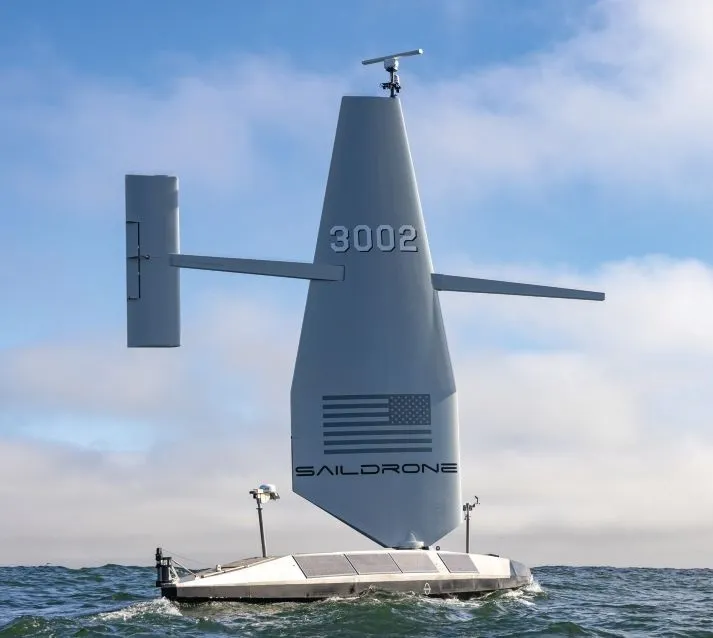
At 20 meters long (65 feet) and 15 tons, the Saildrone Surveyor is the world’s largest unmanned, autonomous vehicle class in operation. Built to the American Bureau of Shipping (ABS) Light Warship code, the Surveyor is equipped with the latest multibeam bathymetry echo sounders for open-ocean surveys. Globally, only 25% of the ocean has been mapped, partially a result of the lack of survey ship capacity. Saildrone built five new Surveyor USVs in 2024, and plans to build more in 2025 to meet increasing demand.
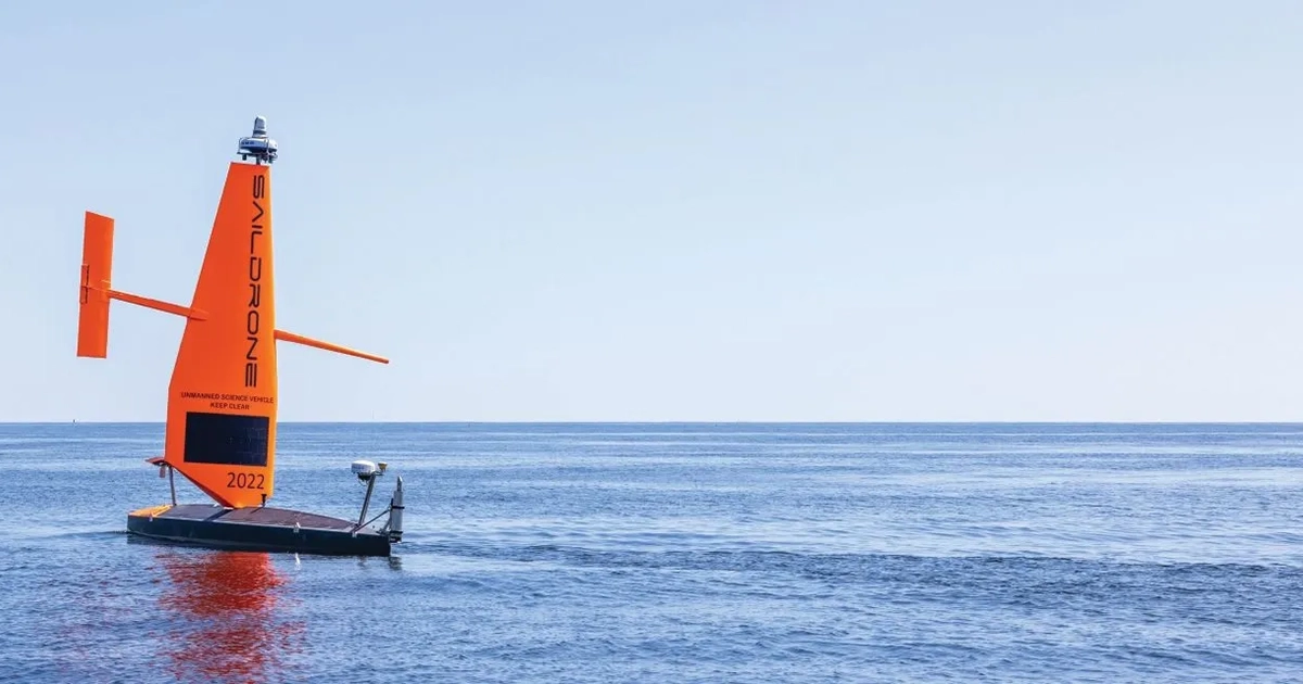
The 10-meter (33-foot) Saildrone Voyager- class USV is designed specifically for near-shore ocean and lakebed mapping. The Saildrone Voyager is the only survey USV that can deliver long-duration International Hydrographic Organization (IHO)-compliant multibeam mapping surveys and ocean data collection at depths up to 300 meters (900 feet).
PROVEN TRACK RECORD
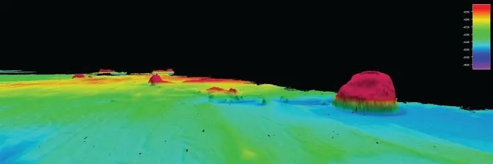
Saildrone has been operating autonomous data collection missions for ocean research, seafloor mapping, and maritime security since 2015. In 2022, Saildrone completed a months-long survey around Alaska’s Aleutian Islands and off the coast of California, during which it discovered a previously unknown seamount standing approximately 1,000 meters (3,200 feet) high from the seabed.
Last year, Saildrone surveyed 1,500 square nautical miles in an area of the north-central Gulf of Maine that had never been mapped in high resolution. The mission supported National Oceanic and Atmospheric Administration (NOAA) deep-sea coral surveys, as well as other NOAA missions. In particular, updated mapping data is necessary to guide the search for deep-sea coral, which serves as habitat for important fisheries.
The mission primarily focused on the Jordan and Georges Basins, at depths up to 300 meters (900 feet). The data revealed a complex and varied underwater landscape, reflecting its glacial history and dynamic oceanographic processes.
Currently, Saildrone is mapping 29,300 square nautical miles (100,530 square kilometers) of the Cayman Islands’ Exclusive Economic Zone (EEZ). This mission represents a major milestone in ocean mapping: using autonomous technology to survey 80% of the Cayman Islands’ EEZ.
Saildrone was selected by the Florida Department of Environmental Protection (FDEP) to map a portion of Florida’s coastal waters in the Gulf of Mexico as part of the Florida Seafloor Mapping Initiative (FSMI). This multiyear effort will provide statewide stakeholders with accessible, high-quality, and high-resolution seafloor data of Florida’s coastal waters within the continental shelf.
Updated mapping data of coastal systems is critical for protecting offshore infrastructure, habitat mapping, restoration projects, emergency response, coastal resilience, and hazard studies for the state’s citizens. Saildrone has been tasked with mapping 2,817 square kilometers of high-resolution multibeam data in a region known as Middle Grounds, approximately 130 kilometers northwest of St. Petersburg.
A CUSTOM APPROACH
Whether a customer requires a single mission or an ongoing data stream, Saildrone’s services can be tailored to meet specific needs. This flexibility makes it easier for organizations to scale their data collection efforts as their requirements evolve.
In the rapidly changing world of ocean exploration, Saildrone exemplifies how technology and vision can transform an industry, delivering unparalleled insights into the health and future of our oceans.
Saildrone is currently operating in the Atlantic, Pacific, and Caribbean.
This feature appeared in ON&T Magazine’s 2025 February Edition, Uncrewed, to read more access the magazine here.