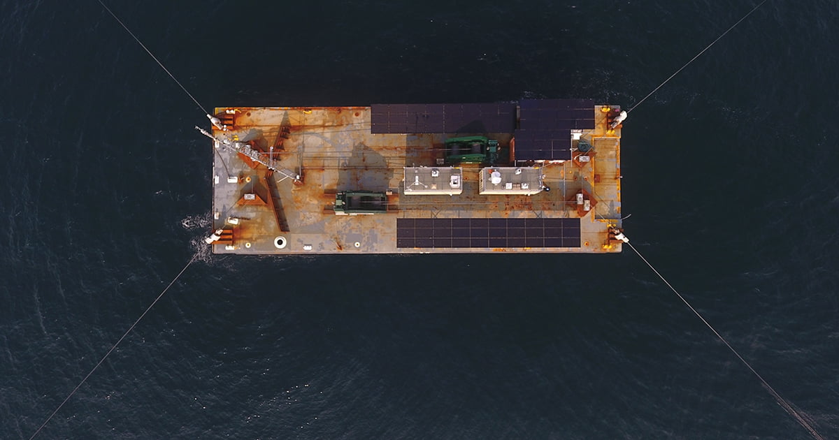
PNNL co-leads WFIP3, which is funded by the Department of Energy’s Wind Energy Technologies Office and composed of experts from more than a dozen research institutions. PNNL oversees the barge’s many instruments, while Woods Hole Oceanographic Institution (WHOI) manages the barge itself.
“Deploying barges for longer periods is not generally done, so our interdisciplinary group of scientists created or adapted a number of the planning and support systems,” said WHOI physical oceanographer Anthony Kirincich. “It’s my hope that future projects will be able to stand on our shoulders to carry out longer deployments at sea with fewer resources.”
In addition to PNNL, collaborators that deployed instruments on the barge include Argonne National Laboratory, National Renewable Energy Laboratory (NREL), and the University of Notre Dame.
“This novel instrumented barge enables us to obtain time-varying profiles of an array of vital variables at a single location for characterizing the marine atmospheric boundary layer—the part of the atmosphere that directly contacts and is influenced by the ocean—which was not possible using conventional research vessels,” said Notre Dame professor of engineering and geosciences Harindra Joseph Fernando.
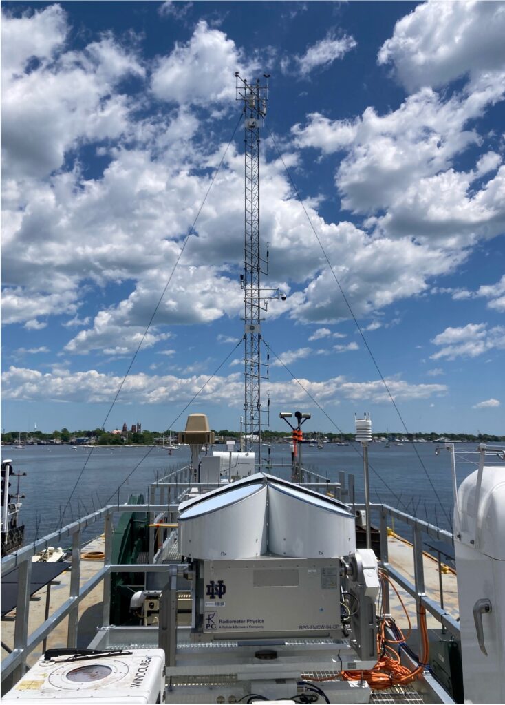
The Notre Dame team deployed a suite of remote sensing instruments on the barge, including a long-range Doppler wind lidar, W-band radar, microwave radiometer, and present weather detector. The Argonne team deployed a micro rain radar, a portable weather radar that detects precipitation above the barge at wind turbine hub height and throughout the boundary layer.
“Wind and precipitation observations from the barge will help improve our weather forecast models, which are key to predicting offshore wind energy budgets,” said Argonne atmospheric scientist Robert Jackson. “Improving these models will help communities determine where to place future offshore wind farms.”
“The measurements we collect will be unprecedented for US offshore wind,” said wind resource modeling and characterization researcher Nicola Bodini, a member of the NREL team that deployed multiple lidars to measure wind characteristics, along with a temperature profiler. “Previous limited observations in the region have shown that turbulence is generally lowest, and the atmosphere tends to be calm (or stable) in the summer. When the atmosphere is experiencing low turbulence, wind farm wakes—areas of slower-moving, more turbulent air downstream from wind farms—tend to persist for longer, which can impact other wind turbines or wind farms downstream. Having direct measurements of atmospheric stability and winds across the boundary layer is crucial for predicting wake losses from offshore wind farms.”
The barge’s suite of instruments also includes privately developed technology, such as DeTect Inc’s MERLIN True3D radar system, designed to handle the complexities of collecting data on avian and bat movements while compensating for the dynamics of being on a moving platform.
“Environmental monitoring technologies such as MERLIN are the perfect complement to the barge’s atmospheric instruments, enabling us to look more holistically at everything it takes to reduce uncertainty and risk around offshore wind development,” said PNNL computer scientist Shari Matzner, who developed ThermalTracker-3D, a thermal stereo vision technology for tracking bird and bat flight, which is also deployed on the barge.
“The barge—and WFIP3 overall—enables deep collaboration among government, research, academic, and industry partners across the country,” said Raghavendra Krishnamurthy, WFIP3 principal investigator and PNNL Earth scientist. “This kind of partnership—with many areas of expertise and resources combined—is what it takes to address the remaining complex challenges the offshore wind industry faces.”
The barge, powered in part by solar panels, battery storage, and occasional use of an onboard generator, will remain at sea until fall 2024 when the team will transfer its instrumentation to a National Oceanic and Atmospheric Administration (NOAA) research vessel to better withstand harsher winter weather. All data collected are transmitted to the publicly accessible Wind Data Hub in near real time.
Learn how the overarching Wind Forecast Improvement Projects have saved millions of dollars so far.