The ground-breaking data, published in the Nature Journal Communications Earth & Environment, will be contributed to The Nippon Foundation-GEBCO Seabed 2030 Project, which aims to have the definitive and complete map of the ocean seafloor by 2030.
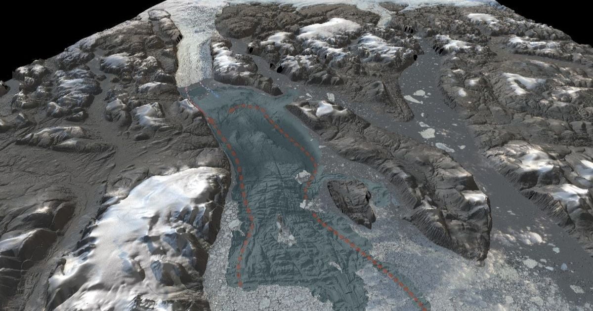
The Swedish icebreaker Oden ventured into the previously unmapped Sherard Osborn Fjord, where the Ryder Glacier drains into the Arctic Ocean. Melting and calving glaciers act as key catalysts for the increasing loss of ice sheet. But the processes controlling advance and retreat of outlet glaciers remain relatively unknown, limiting the ability to assess their fate and contribution to global sea-level rise.
The data show that warmer subsurface water of Atlantic origin enters the fjord, but Ryder Glacier’s floating shelf – at its present location – is partly protected from the inflow by a bathymetric sill located in the innermost fjord. This reduces under-ice melting of the glacier, providing insight into Ryder Glacier’s dynamics and its vulnerability to inflow of Atlantic warmer water. The data may also play a valuable role in undertaking assessments of the North Greenland Ice Sheet’s future retreat.
”The data we have collected aboard Oden provide an important insight into why the future mass loss of the Greenland Ice Sheet is complicated to assess. It also highlights the necessity of having a complete map of the ocean floor,” comments Professor Martin Jakobsson of Stockholm University, co-leader with Professor Larry Mayer of the Seabed 2030 Arctic and North Pacific Ocean Regional Center.
“Seafloor bathymetry, along with in-situ oceanographic measurements, have a very important role to play in acquiring improved assessments of the marine cryosphere’s development in a warming climate.”

