The newly-formed Hydrographic Exploitation Group (HXG) harnesses the latest tech, surveying waters shallow or deep, ocean or coastal, recording details of depth, seabed objects and composition.
That information can directly impact operations, increasing littoral access and maneuvering, understanding of the environment, or helping cartographers redraw charts of the oceans with greater accuracy—for the safety and benefit of all seafarers.
After many years merged with the Royal Navy’s meteorological experts as the Fleet Hydrographic and Meteorological Unit, the two branches have now parted company.
In their place are two new units: one dedicated to surveying and hydrography, the other to all things meteorological, hence the Hydrographic eXploitation and the Metoc Information Warfare Groups (HXG and MIWG, respectively).
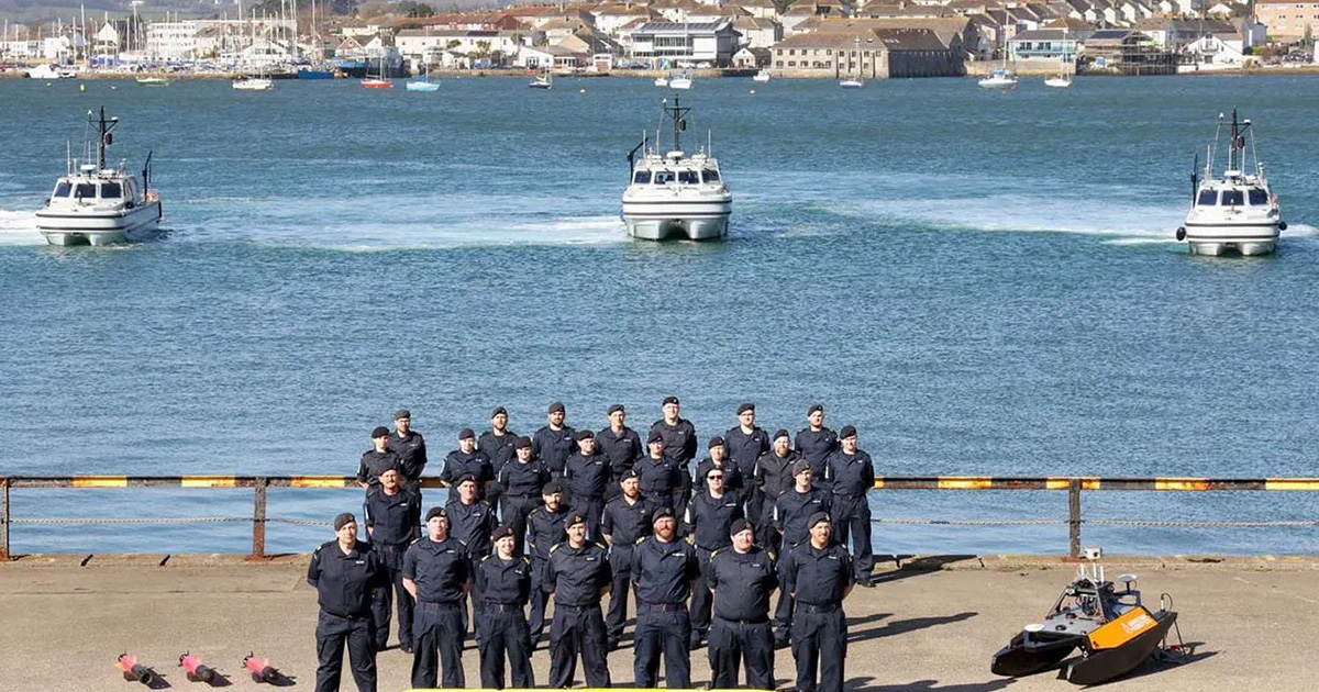
The separation is part of a broader transformation of survey/hydrographic operations, which is shifting the Navy away from traditional survey ships such as HMS Echo and Enterprise in favor of small rapidly-deployable teams, autonomous systems, and 11 and 15-meter Vahana survey motor boats for sustained, detailed work.
After months of training and making use of the panoply of new kit, the HXG is now at full operational capability—able to support front-line operations and conduct hydrographic missions wherever needed—prompting a roll-out of its craft and equipment at Morice Yard in Devonport Naval Base.
Aside from the Vahanas, which are capable of conducting detailed hydrographic surveys using multi-beam echo-sounders, HXG can call upon a number of state-of-the-art autonomous underwater vehicles (AUVs) which can efficiently and precisely carry out surveys of the seabed for charting and wider defense purposes.
The arrival and deployment of the new capabilities on show today is a game changer and, alongside pending developments in larger autonomous platforms—under the Future Military Data Gathering program—makes for an exciting future for the Hydrographic Exploitation Group.
The unit is also equipped with a remotely operated towed vehicle (ROTV), which can be deployed on larger vessels and will further enhance Military Data Collection capabilities in support of the wider Fleet.
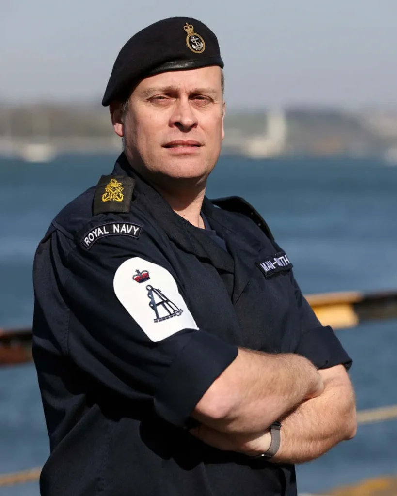
In charge of the new unit is Commander Olivier Barritt, who believes the concentration on a single role will benefit both new groups, with the hydrographic unit looking forward “to delivering a number of refreshed capabilities for the Royal Navy and delivering faster to our frontline users.”
He continued: “Our specialized survey boats are capable of being transported to where they are needed most. More importantly, thanks to close collaboration with Navy Develop and the Future Military Data Gathering program, we have a whole host of surface and sub-surface autonomous vehicles to operate alongside them – or separately.
“This means HXG teams can now deploy with a combination of ‘flyaway’ capabilities that are designed to meet a wide variety of survey requirements.”
Devonport remains the home of Royal Navy hydrography —including the hydrographic school—and the wider Plymouth area is home to “a growing number of hydrographically-focused educational and industrial institutions,” said Commander Barritt, turning the city into “a developing center of excellence which makes it is a great place to be based and to operate from.”