For 2025, NOAA issued a 60% likelihood of an above-normal season, with 13–19 named storms, 6–10 hurricanes, 3–5 major hurricanes. Given the potential for widespread devastation, authorities continue to invest in technologies, both hardware and software, to help improve the accuracy of forecast models and cyclone tracking.
In recent years, we have seen public agencies increase their reliance on remote technologies to accelerate data capture and reconnaissance efforts—underwater gliders and buoys, modified aerial drones and dropsondes launched from Hurricane Hunters, and even USVs sent directly into the eye of a major system to record live footage and real-time marine environmental data.
This extended operational capacity is testament to the commercial success of uncrewed technologies designed to operate on, below, and above the water. These innovative platforms have transformed our capacity to monitor dangerous weather systems and better understand their natural cycle. But what about when the storm passes?
UNCREWED DISASTER RESPONSE
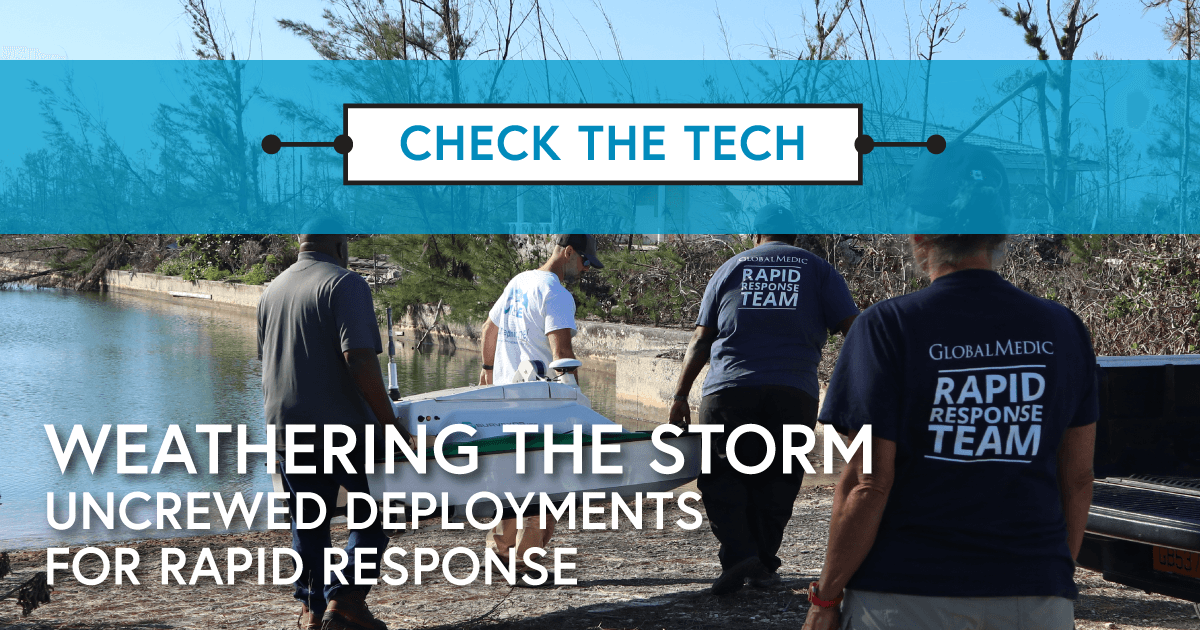
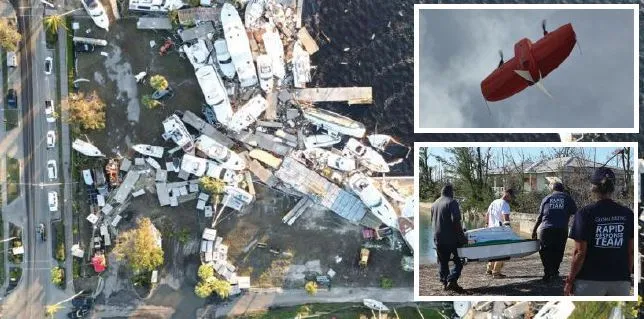
Rapid situational awareness is critical following any major weather event impacting coastal settlements; the capacity to quickly assess damage and existing threats is often a matter of life and death for state governmental emergency management teams, FEMA, and other commercial interests.
Conventional survey methods used to inform action plans in event-impacted areas are expensive, time-consuming, and often put personnel in harm’s way. This is clearly a case for the more widespread deployment of an ecosystem of uncrewed craft to safely and efficiently capture and relay images and data to ground teams trying to piece together a 360-degree view of the scale and severity of impact.
Smaller, compact USVs have proven effective as part of such operations. Advanced sonar and imaging tools can help in search and rescue operations, while detecting submerged debris and assessing channel navigability of inter-coastal waterways. Beyond the immediate aftermath, the data gathered is also essential for both identifying any environmental hazards, such as water contamination, and measuring longer-term impacts, such as significant sediment shifts or structural damage to submerged coastal infrastructure.
Cameras and LiDAR systems enable operators to put eyeballs in hard-to-reach areas from a safe, shore-based command. The ability to deploy multiple USVs working as a synchronized fleet in different locations speaks to the scalability of such an uncrewed response.
SURFACE & SUBSURFACE DATA
Increasingly, survey response teams are taking to the skies to get their own bird’s eye view of impacted regions. The integration of UAVs to aid coastal mapping and monitoring campaigns is nothing new, but the plug-and-play nature of increasingly sophisticated UAVs is driving the ability of marine surveyors to essentially learn a new skill. Once certified—a relatively painless undertaking—commercial marine surveyors can incorporate UAVs, such as a WingtraOne GEN II UAV, to capture time-sensitive high-resolution aerial maps, 3D models, and orthomosaics with ultra-precise accuracy, as tight as 1 cm with Post-Processed Kinematic (PKK).
Many of the latest UAVs, including the WingtraOne GEN II (pictured below), have vertical take-off and landing (VTOL) functionality, so they can deploy from restricted or debriscovered environments and survey hundreds of hectares an hour. With robust weather tolerance and +25 mph sustained wind capabilities, commercial UAVs can support various payloads including red-green-blue (RGB), light detection and ranging (LIDAR), and multispectral sensors for diverse assessment needs.
Correlating surface and below-surface data with multi-spectral imaging from above with unmatched detail is the key to delivering data-supported, actionable insights in the precious hours following a major hurricane or natural disaster impacting vulnerable coastlines.
Those exposed to the annual threats of the Atlantic hurricane season are frequently urged to “hope for the best, prepare for the worst”: The best preparation means optimizing the latest ecosystem of uncrewed technologies—both water-based and by air—to act expeditiously and with purpose.
This spotlight appeared in ON&T Magazine’s 2025 August Edition, Lights, Camera, Action!, to read more access the magazine here.