GCOOS, the Gulf of America Coastal Ocean Observing System, is a 501(c)3 organization responsible for developing a network of business leaders, marine scientists, resource managers, governmental and non-governmental organizations and other stakeholder groups that collect and combine their data to provide timely information about our oceans—similar to the information gathered by the National Weather Service to develop weather forecasts.
For 20 years, GCOOS has been providing on-demand information about the Gulf’s coastal and open-ocean waters that is accurate, reliable, and benefits people, ecosystems, and the economy, and is always seeking new ways to ensure that reliable data reaches the end-users who need it.
The new “GCOOS ERDDAP Model Context Protocol (MCP) Server,” created by GCOOS Developer Bob Currier, bridges another gap between powerful oceanographic databases and less knowledgeable users.
Previously, accessing ocean temperature data, satellite imagery, or marine sensor readings required technical expertise and knowledge of complex database systems. Now, researchers can simply ask their AI assistant questions like “Show me water temperatures in the Gulf of America from last summer” or “Find all the data from underwater gliders near Florida.”
“Ocean data is critical for understanding our climate, managing fisheries, and protecting coastal communities,” Currier said. “But until now, that data has been locked behind technical barriers that many researchers, educators, and policymakers couldn’t easily overcome.”
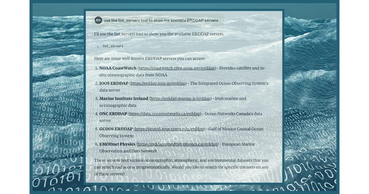
The tool works with popular AI assistants, including Claude and ChatGPT, transforming them into knowledgeable guides for exploring oceanographic data from institutions like the National Oceanographic and Atmospheric Administration (NOAA), the Integrated Ocean Observing System (IOOS), and research facilities worldwide. Users can search through thousands of datasets, preview data with statistics, and download exactly what they need—all through natural conversation.
The GCOOS ERDDAP MCP Server is open-source and available at https://github.com/robertdcurrier/erddap2mcp
The tool allows users to search ERDDAP datasets, retrieve metadata—the data about the data itself —and analyze variables through natural language queries rather than manual URL construction. ERDDAP—NOAA’s Environmental Research Division’s Data Access Program-developed data server—provides a straightforward, consistent way to perform data analysis and visualization and download subsets of gridded and tabular scientific datasets in the file formats of your choice. But learning how to use ERRDAP can be daunting for new users.
The new tool requires no ERDDAP knowledge to start using it, and the repository includes documentation with usage examples demonstrating dataset discovery, variable analysis, and constrained data retrieval across multiple ERDDAP servers, including NOAA CoastWatch, IOOS, and GCOOS.
Installation is straightforward for those with basic Linux or MacOS skills: clone the repository, run pip install -r requirements.txt, and add a 5-line JSON configuration to your AI assistant. The entire setup process takes less than five minutes.
“GCOOS is always striving to remove barriers to oceanographic data,” said GCOOS Executive Director Dr. Jorge Brenner. “This new tool comes at a time when understanding ocean conditions is more important than ever for uncovering climate trends, conserving our marine environment, and developing plans for coastal communities. By making ocean data accessible through simple, plain-language queries, this tool opens new doors for educators, students, policy makers, and citizen scientists to engage with real scientific data that might otherwise have been out of reach.”