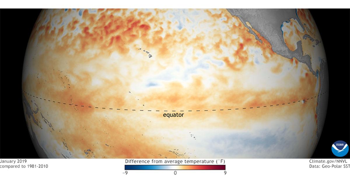
“El Nino conditions across the equatorial Pacific have come together, and we can now announce its arrival,” said Mike Halpert, deputy director, NOAA’s Climate Prediction Center, and ENSO forecaster. “While sea surface temperatures are above average, current observations and climate models indicate that this El Nino will be weak, meaning we do not expect significant global impacts through the remainder of winter and into the spring.” Forecasters say there is about a 55-percent chance that El Nino conditions will continue through the spring. Scientists say that some of the above-normal precipitation this winter in parts of the West is related to subseasonal variability attributed to another climate phenomena, the Madden Julian Oscillation (MJO), rather than El Nino influences. The MJO can trigger enhanced rainfall along the West Coast.
El Nino is a natural, ocean-atmospheric phenomenon marked by warmer-than-average sea surface temperatures in the central Pacific Ocean near the equator. Typical El Nino patterns during winter and early spring include below-average precipitation and warmer-than-average temperatures along the northern tier of the U.S., and above-normal precipitation and cooler conditions across the South. While impacts vary during each El Nino event, NOAA regularly provides temperature and precipitation outlooks for the seasons ahead.
Last winter, La Nina took effect in October 2017 and lasted through April 2018 before a return to neutral conditions. NOAA scientists will continue to monitor the El Nino and will issue the next monthly update on March 14, 2019.
