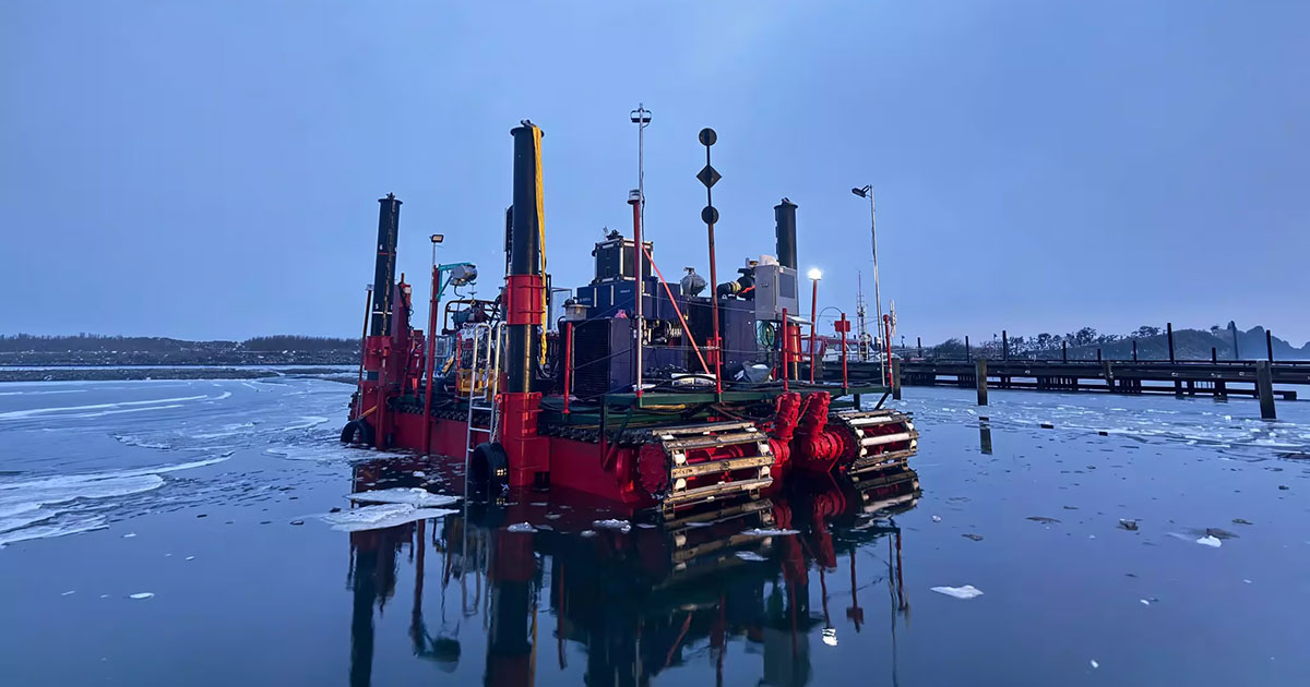
Planned to run until summer, the campaign involves extensive geotechnical investigations in extremely shallow waters around the island of Egholm, where water depths are below 1.5 m. To deliver high-quality data in this challenging environment, Fugro has mobilized its unique Fugro amphibious buggy, which is being deployed in Europe for the first time. The amphibious buggy is a specialized vehicle equipped with crawler tracks and four long support legs, allowing it to drive through extremely shallow water and stabilize itself where survey vessels and land-based rigs cannot operate effectively.
By enabling direct access across intertidal areas, rather than requiring the construction of temporary access routes, the amphibious buggy helps minimize disruption to the fjord environment and reduces the overall footprint of the investigation works. It is flexible and easy to maneuver in shallow water, reducing downtime and supporting a streamlined program of boreholes, cone penetration tests, and sampling activities.
Senior Project Manager at COWI, Elena Peri, who is overseeing this investigation, said: “We look forward to carrying out this program together with Fugro. With the amphibious buggy, we will be able to collect the data needed to fully understand conditions in the Limfjord. Over the coming months, COWI and Fugro teams will work closely together to deliver high-quality results and ensure the most efficient site characterization for this key infrastructure project in Northern Denmark.”
“Introducing the amphibious buggy to Europe for the first time marks an important strategic milestone in how we approach complex shallow‑water investigations,” said Matthew Chappell, Fugro’s Regional Service Line Director for Nearshore. “This project highlights how Fugro’s innovative solutions, technology, and offshore expertise come together to solve challenges that traditional equipment cannot, supporting COWI and the Danish Road Directorate with the high‑quality Geo‑data required for the new Limfjord motorway connection.”
The geo data acquired will play an important role in informing the design of the new transport link, specifically the planned tunnel south of Egholm and the low bridge to the north, both of which require detailed insights into the local geology and soil strength.