Woolpert will collect 1,391 square nautical miles of high-resolution hydrographic survey data to explore deep-sea corals and other sensitive marine habitats, identify seafloor hazards, detect changes to the underwater environment, and update NOAA’s nautical charting products to enhance maritime safety.
“This project will fill gaps in modern seafloor mapping data in the Gulf of America,” said Chris Taylor, Ph.D., ecologist with NOAA’s National Centers for Coastal Ocean Science. “New maps of seafloor bathymetry and texture will be used by NOAA and our partners to develop new habitat maps and characterizations supporting the restoration of mesophotic and deep benthic communities in the region that were damaged during the Deepwater Horizon oil spill.”
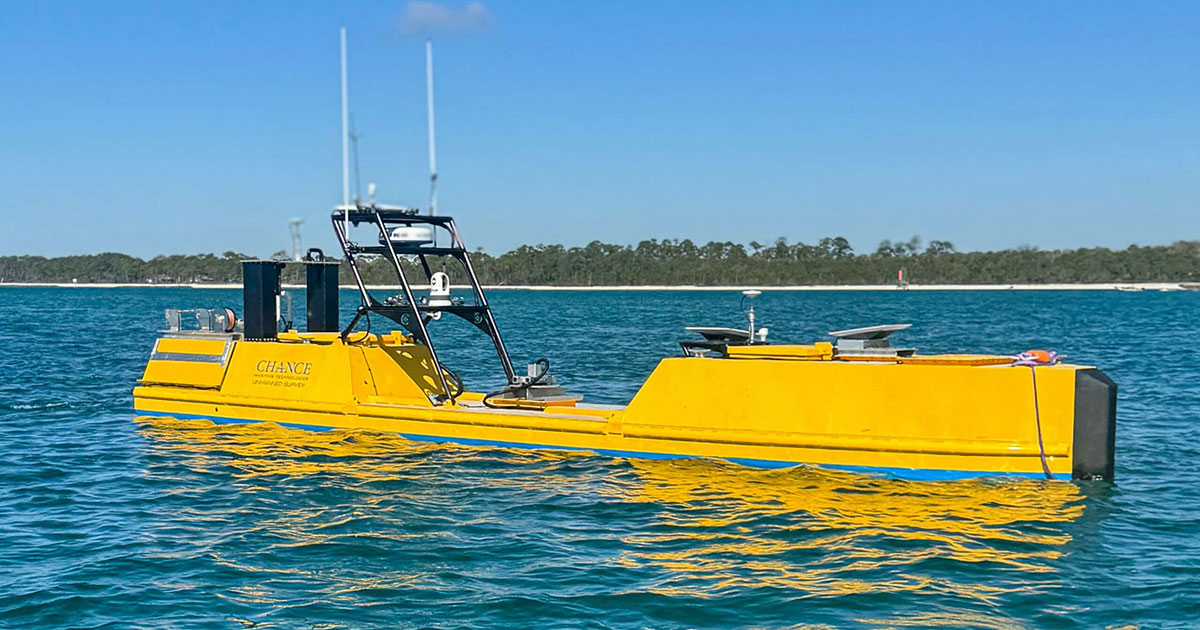
To complete the mission, Woolpert enlisted Chance Maritime, mobilizing its new high-power, extreme long-endurance 40-foot uncrewed survey vessel, Chance MC40. Woolpert also deployed a second USV, Chance Maritime’s Chance MC29, to increase efficiency and accelerate data collection timelines. The vessels enable continuous remote hydrographic survey operations without crews on board.
Over the multi-month project, Woolpert will survey approximately 11,000 linear nautical miles. Woolpert hydrographers, positioned across multiple time zones, will remotely conduct hydrographic surveys around the clock. Survey data is uploaded to a cloud server via Starlink satellite communications, where it is ingested into Woolpert’s Automatic Survey Production Environment (ASPEN) and made ready for further postprocessing by Woolpert’s hydrographic processing team.
According to Woolpert Program Director Dave Neff, uncrewed survey vessels significantly enhance offshore data collection capabilities and are increasingly being used for deep-ocean missions.
“Uncrewed vessels allow us to collect high-quality hydrographic data more efficiently and safely, particularly in challenging deep-ocean environments,” Neff said. “This project demonstrates just how valuable USVs are in expanding our access to critical ocean data while reducing operational risk. We’re proud to support NOAA’s mission and to help set a new precedent for large-scale offshore marine mapping.”
The survey is underway and expected to be completed later this year.
This mission builds on the successful hybrid crewed/uncrewed survey completed last year by Woolpert and Chance Maritime. Utilizing the Chance MC29 and Woolpert’s R/V Thunder, over 6,000 linear nautical miles of multibeam seafloor bathymetry were collected between both vessels in support of the Florida Seafloor Mapping Initiative.