The global mapping of seabeds, coastlines, and marine ecosystems is far from complete. Meanwhile, the importance of oceans, lakes, and rivers for economic use is growing. Oil and gas production facilities, offshore wind farms, and dams are examples of an expanding underwater technical infrastructure that requires regular monitoring. To address the mapping gap, HafenCity University Hamburg (HCU) initiated the week-long surveying camp “Pramuka Field Work 2025” in collaboration with the Indonesian Institut Teknologi Bandung (ITB), which is based in Bandung, Java. The research mission was to test different measurement methods in a real marine environment, compare the data quality of various sensors, and subsequently combine all the data into a comprehensive model.

With visibility depths of up to 12 meters, the waters around the Indonesian island of Pramuka offer ideal conditions for underwater measurements. “We wanted to find out what data quality the individual sensor types deliver and how the data complement each other. Especially LiDAR systems offer very high spatial resolution. This allows us to create detailed 3D models of underwater structures,” said Prof. Dr.-Ing. Harald Sternberg, head of the Hydrography and Geodesy department at HCU and member of the FIG/IHO/ICA International Board on Standards of Competence for Hydrographic Surveyors and Nautical Cartographers (IBSC).
First-Ever Combination of Drone and Underwater LiDAR Data
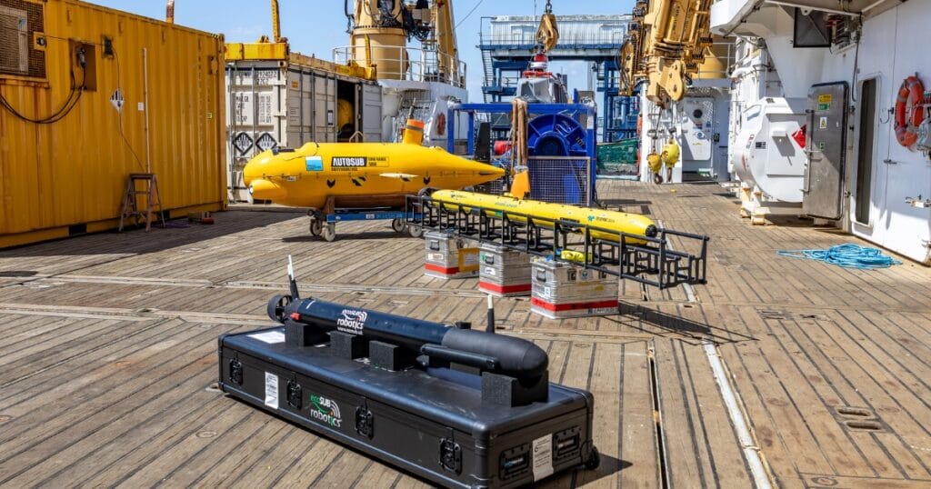
The 34-person research team used various sensors to map the entire coastline of the small island. Test objects were installed at depths of up to 10 meters. The team used a multibeam sonar system (fan echo sounder), a photogrammetry sensor, and two high-end LiDAR systems from Fraunhofer IPM. Laser-based measurement techniques for underwater applications are becoming increasingly important, as they complement data from traditional acoustic or camera-based measurement systems. The Underwater LiDAR System ULi, for example, captures underwater objects in 3D with much greater precision than sonar systems. The Airborne Bathymetric Laser Scanner ABS enables high-resolution bathymetric measurements from the air. “In Indonesia, we used both systems simultaneously for the first time. That means we captured the same scene from the air and underwater with LiDAR. The merged data will once again demonstrate the power of these systems,” said Prof. Dr. Alexander Reiterer, head of department at Fraunhofer IPM.

Publicly Accessible 3D Data Model
The processing and evaluation of the enormous amount of measurement data will take several more months. In addition to the generated measurement data, satellite data will be incorporated into the Pramuka coast’s publicly accessible data model. The HCU and ITB plan to use the findings from the field trial to improve global hydrographic standards. One thing is clear: mapping bodies of water is becoming increasingly important due to increased economic activity. And the endangered marine ecosystem, with its threatened coral reefs and tons of plastic waste floating on the ocean’s surface, also creates challenges for innovative measurement technology.