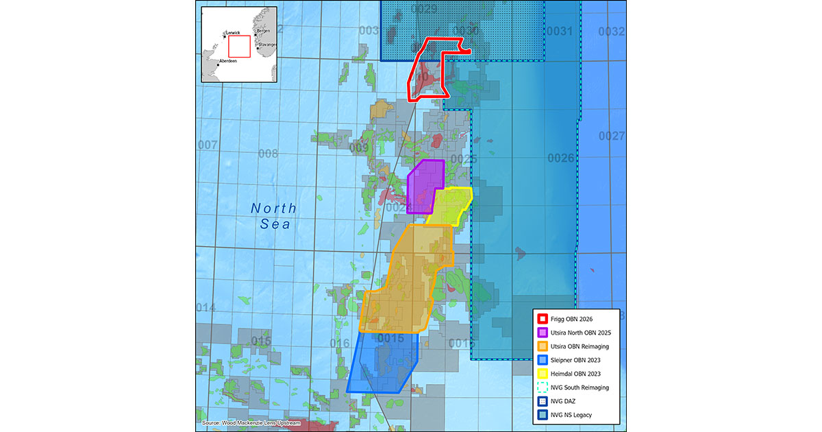
As an OBN imaging leader, Viridien will apply its proprietary OBN processing and imaging technologies, including Time-Lag Full-Waveform Inversion, to this new survey. The resulting dataset will deliver enhanced resolution and structural definition across the region’s complex geology and reservoirs. This survey, supported by industry funding, will add to Viridien’s growing multi-client OBN library in the North Sea.
Dechun Lin, Head of Earth Data, Viridien, said: “The start of this new survey highlights Viridien’s long-term commitment to the North Sea and to supporting our clients with high-quality multi-client data programs. Our extensive experience in the area, combined with our proven OBN imaging technologies, positions us to deliver valuable new insights for infrastructure-led exploration across this important cross-border region.”