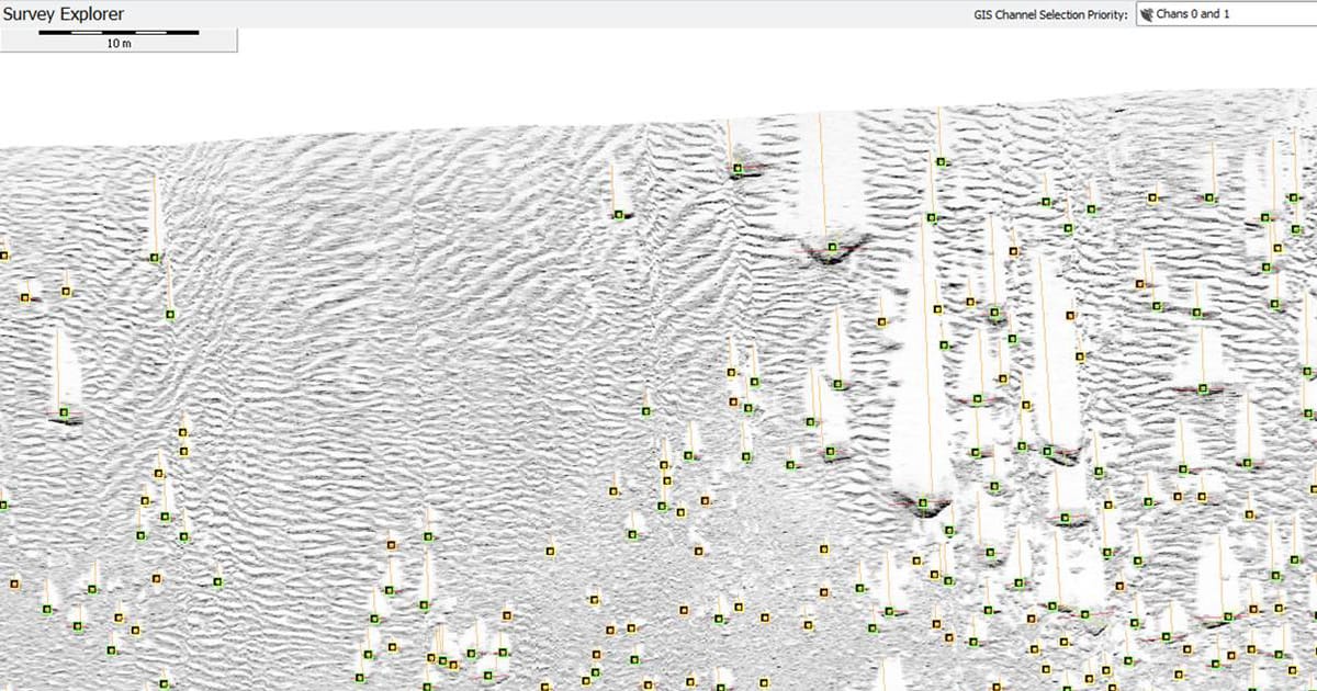
Large survey projects covering hundreds of line kilometers and many tens of gigabytes of sonar data can take geophysicists weeks to sift through manually, identifying and measuring tens of thousands of boulders. SEADP offers the ability to do this automatically, in a matter of minutes, accurately finding the location and dimensions of the vast majority of boulders within the target area.
Rigorous and extensive tests of this newly trained model have shown that this Model accurately identifies up to 65% more boulders in complex environments than the company’s earlier Model and performs measurements on them with greater reliability, all without compromising on processing speed or the existing low rate of false positives. As well as positions and dimensions, the model can generate a snapshot of every target and report on how confident it is about each individual boulder.
Survey Engine incorporates quality control tools to allow human review of the output prior to reporting. The latest SEADP release also benefits from Survey Engine’s multi-line deduplication processing feature, allowing boulders detected on overlapping sidescan lines to be automatically identified and flagged for review, before being marked as duplicates or confirmed as distinct. Marked duplicates can be removed from any report output using the software’s powerful filtering tools.
The output from SEADP is completely user-configurable—features such as the boulders’ locations, dimensions, route offset distances and confidence values can be exported to a range of formats, with snapshots of each individual boulder included where the format permits.