Commenting on the news, Dr. Joel Hirschi, Associate Head of Marine Systems Modelling at the National Oceanography Centre (NOC) said:
“Not only have we have seen record high sea surface temperatures, but the data show that these temperatures are appearing earlier than their usual peak of March. This means there is a high chance of seeing an increase in global SSTs over the next 1-2 months that markedly exceeds the 2023 record.
“Higher SSTs, if they persist towards spring lead to a higher likelihood of a very active global hurricane season in the Atlantic. Around the UK specifically, SSTs are abnormally warm. As these affect the majority of our weather systems, the warmer winds increase the chance of heavy rainfall with the potential for heavy snowfall if this mild maritime air collides with cold air masses from the Arctic and/or Northern Europe.”
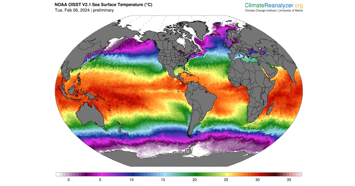
This data comes from Climate Reanalyzer which provides daily updates on sea surface temperatures across the world. The data show average SST is now 21.1C which already exceeds the previous record high recorded in August 2023.
Primary responsibility for this increase can be attributed to:
- Ongoing climate warming
- The El Nino phenomenon
- Widespread warm anomalies across the Atlantic, Indian Ocean and Northwest Pacific
Dr. Hirschi expects the El Nino phenomenon to wane from spring and early summer which should lead to average SSTs dropping from summer and early autumn in 2024. El Nino waning, however, increases the likeliness of a more active hurricane season as it acts as a break on Atlantic hurricanes.
View data on Climate Reanalyzer


