The study, published in Marine Pollution Bulletin, demonstrates how satellite data can be used to define a methodology to protect 30% of the ocean seascape, which provides important habitats for migratory birds, large fish, turtles, cetaceans and mammals including whales, dolphins and porpoises.
A Strategy to Protect Key Habitats
The study found that protecting 30% of the high seas would be an effective strategy for protecting endangered species. Asier Anabitarte, lead author of the study and researcher in sustainable fishing technologies at Centro de Investigación Marina y Alimentaria (AZTI), a scientific and technological center specialized in the marine environment, clarified, “We calculated the center point of each seascape and then determined that, by diverting marine traffic around rather than through protected areas, we would achieve the UN’s goal of effectively protecting 30% of biodiversity, without heavy disruption to fishing and shipping.”
The study was funded by ESA’s Science for Society Biodiversity in the Open Ocean: Mapping, Monitoring and Modelling (BOOMS) project.
Marie-Helene Rio, ESA Ocean Applications Scientist and technical officer for the project, said, “By protecting at least 30% of each seascape with activity lanes is a good starting point for high seas protection, which can be redefined later based on the presence of rare species or key habitats and socioeconomic factors agreed with stakeholders within a systematic spatial planning approach.”
Anthropogenic Impacts on Oceans
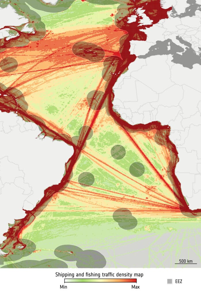
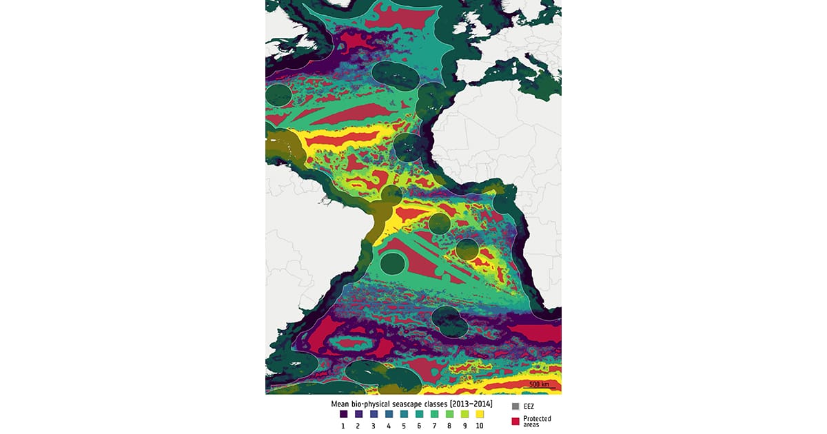
The main human activities in the high seas are fishing and shipping, with noise and emissions the most significant forms of pollution. Automatic Identification System data were used to estimate the level of activity, as shown in the image on the right.
Dr. Anabitarte said, “Noise pollution from human activity can be disruptive and damaging to marine habitats because it can affect how cetaceans communicate and hunt. However, it also affects fish populations by interfering with their ability to sense their environment, their ability to mate, communicate, and avoid predators.
“The paper considered a variety of ways that noise affects biodiversity, taking into account the type of ship, the density of traffic, and the decibels emitted.
“Other impacts from shipping and fishing lanes on the high seas should be considered in future studies, including vessel strikes on mammals, as well as consequences of fishing such as seafloor damage, accidental loss of species and litter.”
Victor Martinez-Vicente, a bio-optical oceanographer and coordinator of BOOMS at Plymouth Marine Laboratory, said, “The biogeography of the ocean has a long history, yet the novel application described in Asier’s paper is a demonstration of the potential that satellite-derived data has to support marine policy at the global scale.”
Challenges to protecting our oceans
Areas beyond national jurisdiction—or high seas—makeup about two-thirds of the oceans, but only 1.45% of these habitats are protected. However, our oceans are subject to a number of threats, such as overfishing, oil, gas, and mining industries, and the impacts of climate change.
A United Nations agreement, known as Biodiversity Beyond National Jurisdiction, adopted on June 19, 2023, seeks to establish protected areas in the middle of the ocean, where there is a need for conservation and sustainable practices to protect the rich biodiversity including rare or threatened species of fish, mammals and invertebrates. It aims to protect 30% of the oceans by 2030, part of the 30 by 30 target.
However, there are numerous challenges, including limited data on biodiversity in the oceans.
Using Satellites to Define a Seascape
The study divided the Atlantic into areas called seascapes to help the preliminary designation of protected areas. Each seascape is defined by its biological and physical characteristics. Dr. Martinez-Vicente explained, “We used bio-physical seascapes, which are areas representing ecosystems with similar characteristics detectable from space. Data on the biological variables come from the Ocean Colour project from ESA’s Climate Change Initiative (CCI).”
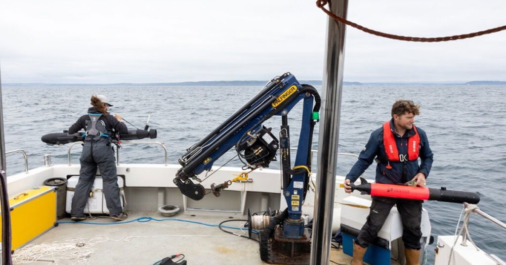
Data from ESA’s Envisat, the EC Copernicus Sentinel-3, as well as the US Aqua, OrbView-2, and NOAA-20 satellites were used to generate seascapes. These data enabled the team to analyze and build models of biodiversity at different levels of the food chain, for example, phytoplankton, commercial fish, and top predators, particularly focusing on endangered, threatened, and protected species. The data were then analyzed in conjunction with human activities on the ocean.