Teledyne CARIS™ Announces the Release of Bathy DataBASE™ (BDB) 4.4

New Lidar classification editing tools (Acknowledgement: Contains information licensed under the GeoNB Open Data License)

Teledyne CARIS™ announces the release of Bathy DataBASE™ (BDB) 4.4. This new version addresses the important areas of feature generalization and automation of product generation for chart compilation, as well as the increasing emphasis on bathymetric Lidar surveys.

A collection of new techniques for generalizing bathymetry in chart compilation workflows can be found in BASE Editor™, which is part of the BDB suite. Point suppression and smoothing techniques help reduce the manual work associated with turning survey data into chart ready vector features. These techniques can be used in isolation or together with other bathymetric feature compilation tools to produce the best results possible.

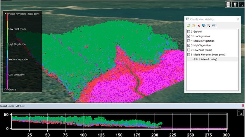
New Lidar point cloud editing tools allow for visual inspection, elimination BDB 4.4 also offers improved automation for S-102 and bENC overlays through the inclusion of new sample process

More in Science & Tech

Latest Issue:

Hurricane forecasting, vigilant naval security ops, marine biodiversity studies, and the responsible exploration of ocean-based resources…

Your cON&Tent matters. Make it count.

Send us your latest corporate news, blogs or press releases.

Search