The collaboration aims to improve regional geological understanding through integrated facies mapping products. These data sets support operators and investors in evaluating hydrocarbon potential, reducing exploration risk, and improving decision-making.
TGS FMB products will be developed using a systematic methodology that integrates seismic interpretation, well data analysis, and regional geological studies. Advanced geospatial techniques will be applied to ensure accuracy and relevance of the outputs.
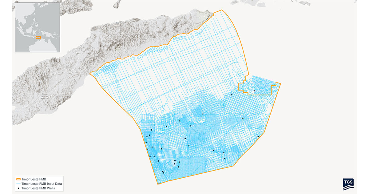
The project covers approximately 53,500 square kilometers across offshore Timor-Leste. Initial FMB data sets are expected within seven to eight months to support early engagement with industry stakeholders. This includes participation in upcoming licensing opportunities, including the third Timor-Leste petroleum licensing round.
The partnership supports ongoing efforts to promote data accessibility and sustainable resource development in the region.