Antarctic ice cliffs are retreating amid warming, and intense ice–ocean exchange shapes coastal environments. High-resolution nearshore topography underpins ice–ocean studies and safe station resupply, since icebreakers cannot approach shallow bays and small boats need reliable depth data. Conventional vessel sonar is inefficient and risks grounding; satellite imagery has limited resolution; airborne lidar is costly; spectral bathymetry is substrate-sensitive. Uncrewed Aerial Vehicle–Structure-from-Motion (UAV-SfM) offers low-cost mapping, but water refraction, floating ice, and large gravel complicate seabed extraction. Seal Bay near China’s Qinling Station exemplifies these conditions. Given these challenges, in-depth research is needed on cost-effective, high-resolution bathymetric mapping in remote Antarctic shallow gravel-bed bays.
A Sun Yat-sen University-led team, with the Key Laboratory of Marine Environmental Survey Technology and Application, Ministry of Natural Resources, and the Polar Research Institute of China, published (DOI: 10.34133/remotesensing.1071) the study on September 3, 2026 in Journal of Remote Sensing. It addresses a practical gap: shallow Antarctic bays need accurate seabed maps for navigation, station construction, and equipment deployment, yet conventional surveys are slow, costly, or unsafe. The team tested UAV-SfM photogrammetry as a non-invasive, consumer-camera-based alternative directly in gravel-bed settings.
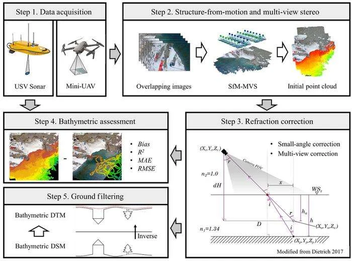
At Seal Bay, the workflow reconstructed dense point clouds and produced a bathymetric digital terrain model (DTM) after two corrections. Under nadir viewing, small-angle refraction correction achieved R²=0.83, RMSE=0.43 m, MAE=0.35 m, and Bias=0.16 m against uncrewed surface vehicle (USV) sonar; multi-view correction was slightly weaker (R²=0.81, RMSE=0.45 m). Cloth simulation filtering removed floating ice and large gravel with classification accuracy above 97%, precision about 98.7%, and F1 near 0.987. Compared with vessel sonar, satellite, or airborne lidar, the method uses low-cost field UAV images and consumer cameras to deliver high-density, spatially continuous shallow-water terrain and integrate land and underwater data in a single coordinate system.
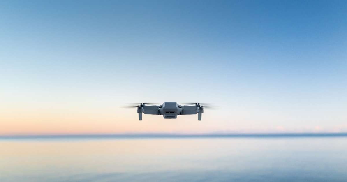
Four DJI Mavic 2 Pro flights surveyed Seal Bay in January–February 2022 at 100 m altitude with 80% frontal and 60% side overlap; ground sampling distance was 2.13–2.44 cm. A CHCNAV Apache 3 USV with 200 kHz single-beam sonar and real-time kinematic (RTK) collected 2,138 depth points at ~0.96 m spacing over 0.01 km²; sonar accuracy was ±1 cm + 0.1% depth. Pix4Dmapper generated dense clouds, and CloudCompare extracted initial bathymetry using a water-surface elevation of −59.60 m. Most depths were shallower than 6 m; errors grew beyond 3 m. Small-angle correction increased maximum mapped depth from 7 m to 9 m. Refraction indices were 1.00 and 1.34; small-angle correction used h=1.34ha, while multi-view correction used per-point angles. Cloth simulation filtering (CSF) used cloth resolution 0.2 m, 500 iterations, and 0.5 m threshold. Filtering raised 2 m grid voids from 0.44% to 2.25%, near low-texture holes.
The research team said the workflow is not a universal replacement for sonar or lidar but a practical complement for remote shallow bays. They noted that water clarity, seabed texture, ice, weather, and tides control success, and that oblique images and machine-learning refraction correction could improve accuracy. The approach may support station safety and repeat surveys.
The team flew overlapping nadir UAV images, reconstructed dense point clouds with SfM–multi-view stereo (MVS) in Pix4Dmapper, and extracted underwater points below a manually digitized water-surface elevation in CloudCompare. They applied small-angle and multi-view refraction corrections, validated depths against USV single-beam sonar, and used cloth simulation filtering to separate seabed terrain from floating ice and gravel. Accuracy was assessed against manually classified points in a 100 m by 100 m plot using accuracy, precision, recall, and F1. Products were georeferenced in WGS 1984 UTM Zone 58S.
Future work should optimize UAV acquisition, including oblique images and pre-calibrated cameras, to reduce doming and holes. Machine-learning refraction correction may curb depth-dependent errors beyond 3 m. The workflow could be repeated for seasonal monitoring of ice–ocean interaction, station support, and habitat mapping along Antarctic coasts. It may guide low-cost bathymetric surveys in other remote gravel-bed bays, though clear water and seabed texture remain prerequisites. Wider adoption could improve coastal change detection and safe operations while complementing sonar and lidar.