Viridien Launches Guyana Legacy 3D Seismic Reimaging Project

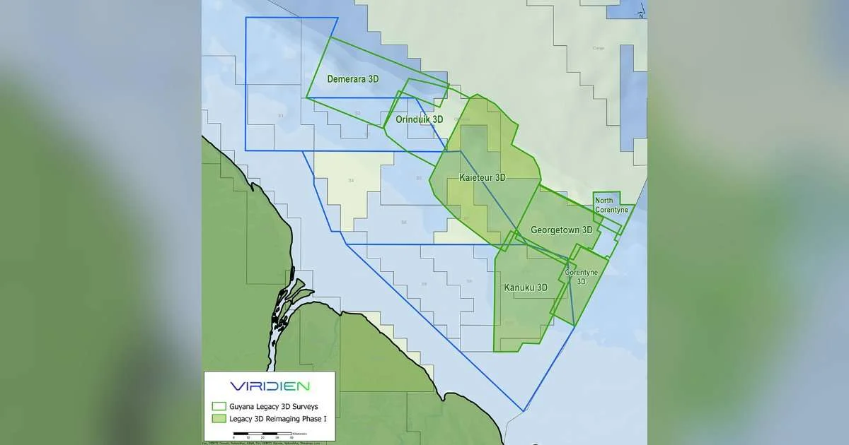
Viridien has commenced Phase 1 of the Guyana legacy 3D reimaging project, covering more than 10,000 km² of existing 3D seismic data across the Kaieteur, Georgetown, Kanuku, and Corentyne surveys. The project has already received strong industry support. Early-out results will be available in Q1 2027.

Map showing the location of Guyana Legacy 3D Reimaging project. (Image credit: Viridien Earth Data)

Leveraging Viridien’s advanced imaging technologies and expertise, the project is designed to deliver enhanced subsurface clarity updip of the prolific Stabroek Block and across Guyana’s shallow-water open acreage.

Integrated with new 3D data, the reimaged surveys will create a seamless regional dataset spanning more than 14,000 km², providing explorers with valuable insights to evaluate emerging plays, infrastructure-led opportunities, and future licensing potential offshore Guyana.

Viridien holds exclusive access and commercialization rights to the legacy datasets. To learn more, contact the Earth Data team at datalibrary.nala@viridiengroup.com.
Don't miss the headlines. ON&T's top news, every week.

More in Subsea & Survey

Latest Issue:

As operations push further offshore and into deeper waters, knowing where something is, keeping it connected,…

Your cON&Tent matters. Make it count.

Send us your latest corporate news, blogs or press releases.

Search

ON&T Newsletter

One email a week. Unsubscribe anytime.
Newsletter Subscription