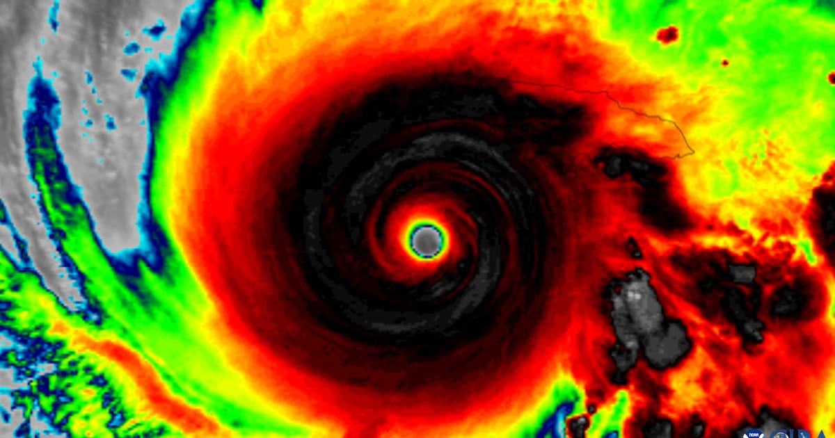
This study is the first to use decades of radar observations to identify the storm structure, environmental conditions, and rainfall patterns associated with tropical cyclone alignment, providing forecasters with new indicators of when a developing storm is likely to organize and intensify.
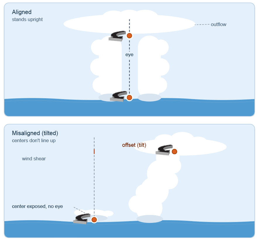
The most powerful tropical cyclones are characterized by an aligned vortex, a strong circulation center that extends vertically and symmetrically from the ocean surface upwards. But many developing storms begin with their circulation tilted or misaligned, and predicting whether they will become vertically aligned has long been a challenge.
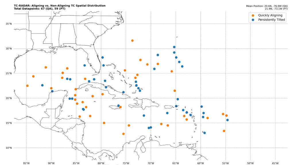
By comparing tropical cyclones between 1997 and 2024 that became vertically aligned against those that were persistently tilted, researchers from the University of Miami Rosenstiel School, the University of Miami’s Frost Institute for Data Science and Computing, NOAA’s Atlantic Oceanographic and Meteorological Laboratory (AOML), and the Cooperative Institute for Marine, Atmospheric, and Earth Studies (CIMAS) identified four characteristics that signal a likelihood for successful alignment.
“Understanding the conditions for vertical alignment means we are no longer just reacting to rapid intensification, we are anticipating it,” says George ‘Trey’ Alvey, Ph.D., CIMAS meteorologist with the Hurricane Research Division at NOAA AOML.
Radar: Revealing the 3D Structure of Storms
To identify features indicative of vertical alignment, the team analyzed airborne Doppler radar observations from the Tropical Cyclone Radar Archive of Doppler Analyses with Re-centering (TC-RADAR) database, a 27-year collection of airborne data. Collected aboard NOAA Hurricane Hunter aircraft, the radar scans measure precipitation and winds as the aircraft flies through tropical cyclones, much like a catscan.
The observations are combined into three-dimensional views of each storm, allowing researchers to see where the strongest winds occur, how the circulation changes with height, and where the most intense rainfall is concentrated.
The team focused on weak tropical cyclones whose circulations were initially tilted. They then grouped the storms based on what happened over the following 24 hours: those whose circulations became vertically aligned and those that remained persistently tilted. Comparing the two groups revealed the atmospheric and oceanic conditions most closely associated with successful alignment. The study also highlights the importance of observations near the ocean surface, where heat and moisture from the ocean fuel storm development.
Four Key Features Underpin Vertical Alignment
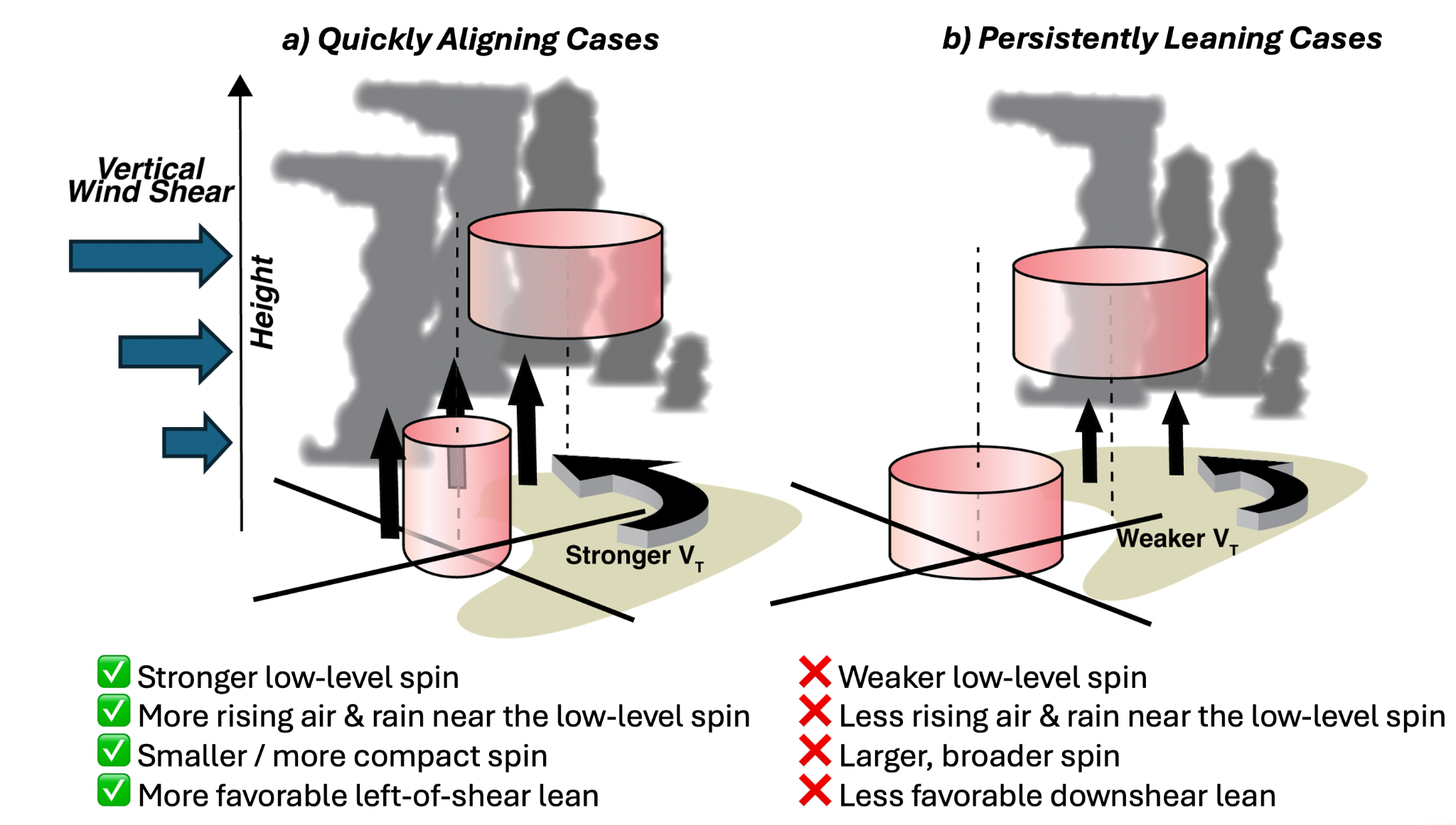
A Strong, Compact Circulation Near the Ocean Surface
In instances where tropical cyclones quickly align, there is a well-defined, tightly organized circulation near the sea surface. In contrast, storms that remain tilted tend to exhibit a broader, weaker circulation, making it harder for the storm to organize into a vertically stacked system.
A Favorable Tilt
The initial direction of tilt is a determining factor in whether a system will align or not. In storms that vertically align, tilt is often left-leaning of the environmental vertical wind shear. This orientation makes them less susceptible to vertical wind shear, a change in wind direction or speed at mid-to-high altitudes that can disrupt tropical cyclone organization.
Rising Air and Rain
Stronger upward motion and heavier rainfall near the low-level center favor the alignment of tropical cyclones.
Warm Water and Abundant Moisture
Warm ocean water provides the energy that powers tropical cyclones. Forming over warmer waters with plentiful atmospheric moisture and relatively weak winds in the middle levels of the atmosphere is a key feature of vertical alignment.
By uncovering the conditions that help a storm become vertically aligned, the study provides forecasters and scientists with new information on what to look for in tropical cyclones that could rapidly intensify.