The GIANT project team spent 30 days working in a remote fjord in East Greenland, gathering data that they hope will transform our understanding of one of the biggest uncertainties in climate science.
GIANT co-lead Dr. Kelly Hogan, a Marine Geophysicist at British Antarctic Survey (BAS), said the expedition had exceeded expectations:
“We’ve gathered so much unprecedented data, from the physics of tiny cracks on the glacier face to the circulation and mixing patterns of the fjord. These measurements mean we can make a big leap forward in our predictions for Greenland’s impact on ocean circulation.
“We were told by our funders, ARIA, to really push at the edge of what we thought was possible—because we’re seeing the environment change in these remote places very quickly. We’re so proud that we managed to get virtually everything we hoped for.”
The team selected Sorgenfri Gletsjer’s 3-miippugut fjord for its ideal conditions: accessible enough for the ship, but active enough to observe real change at the ice face.
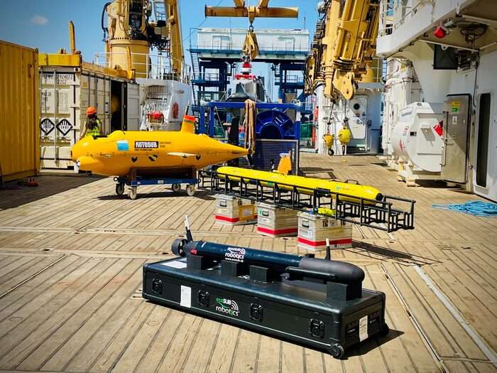
Over the month-long expedition, researchers deployed instruments 523 times. At the glacier face, the surface vehicle DriX mapped and imaged the uppermost ice, while underwater vehicles Gavia and ecoSUB mapped below, building a picture of how the ice face changes over time. The team produced 30 glacier face maps from this water-based fleet, matched by simultaneous drone maps.
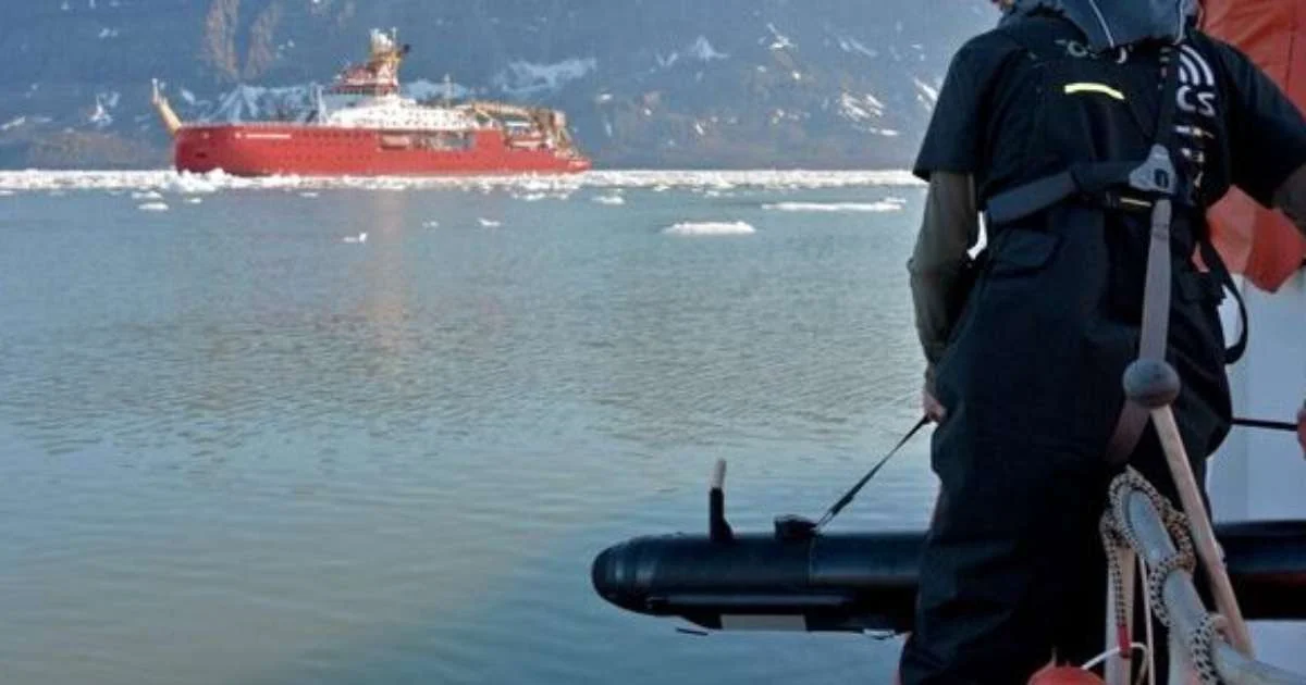
Sonardyne’s Ranger 2 Ultra-Short BaseLine (USBL) positioning system onboard the RRS Sir David Attenborough and a Mini-Ranger 2 USBL system on the daughter craft Erebus were used to track and control formation operation of the mission’s underwater vehicles as they mapped the glacier’s underwater face.
On land, a helicopter-supported team used drone mapping and seismic sensors to track ice sheet changes across the glacier’s main trunk, linking observations in the fjord to glacier flow further upstream.
Meanwhile, the ship’s oceanography team worked around the clock, completing 261 CTD casts to understand how the seafloor and tides shape water movement through the fjord.
A remotely piloted rib named “Polly”, working alongside a tethered ROV, inserted a Meltstake instrument directly into the glacier face to measure how fast ocean currents were melting the ice. This was the first ever Meltstake deployment in Greenland, whose sensors collected data millimeters from the glacier face continuously for 19 hours.
Flying close to the seafloor, supported by Ranger 2 USBL positioning, the National Oceanography Centre’s autonomous submarine Autosub Long Range (ALR), better known as “Boaty McBoatface”, explored beneath kilometers of glacial melange. This marked the first time the autonomous underwater vehicle (AUV) has been deployed under this “inverted Manhattan” type of ice debris.
On land, a helicopter-supported team used drone mapping and seismic sensors to track ice sheet changes across the glacier’s main trunk, linking observations in the fjord to glacier flow further upstream.
Meanwhile, the ship’s oceanography team worked around the clock, completing 261 CTD casts to understand how the seafloor and tides shape water movement through the fjord.
Michelle Barnett, Business Development Manager, Ocean Science, at Sonardyne, said:
“Our acoustic and inertial systems provide the positioning layer that helps underwater robots know where they are, stay coordinated and return reliable scientific data.
“In simple terms, GIANT is not just about sending robots closer to the ice, which is ambitious in itself. It is about turning multiple vehicles into a connected observing system capable of gathering measurements scientists have never captured before.
“By helping those robots operate safely and accurately in one of the harshest environments on Earth, Sonardyne is enabling research that could improve climate models and deepen understanding of a critical global challenge.”
Project co-lead Dr. Pierre Dutrieux, an Oceanographer at BAS, said the scale of robotics and remote technology used was unprecedented for a single polar science expedition:
“GIANT has lived up to its name already. We aren’t aware of another polar science expedition that has had this volume of technology and robotics used in a single science schedule.
“But for all we talk about autonomy, the reality behind the robots is still people. In this extreme environment, you need a skilled team of engineers and scientists behind the controls who are ready to collaborate and support each other. You also need an experienced and accomplished crew running the ship at the center of the operation. Everybody on this expedition played their part in pushing the boundaries of how we do polar science.”
Greenland is home to the world’s second largest ice sheet, which meets the ocean through a vast network of glaciers flowing through hundreds of narrow fjords. Currently, global climate models cannot accurately capture the complex ways these glaciers interact with the warming ocean, a gap that matters because melt from Greenland’s ice could significantly alter major ocean currents in the North Atlantic. These currents act as a “conveyor belt” of heat and nutrients towards Europe, which help shape the temperate climate and sustain marine ecosystems across the ocean.
Over the next three years, researchers will use the data gathered to build more accurate models of how the warming ocean melts Greenland’s glaciers, and how the resulting fresh water moves through the fjords and mixes into the wider Atlantic. The GIANT project aims to feed the findings into the UK Earth System Model, with the ultimate goal of contributing to an early warning system for major changes in ocean circulation.
GIANT is part of the Forecasting Tipping Points programme, funded by the UK’s Advanced Research + Invention Agency. The project is led by BAS, but it stretches across 16 institutions and technology partners across the UK, Greenland, Denmark, France, and the USA. These are: Scottish Association for Marine Science, University of Reading, Leeds University, University of Stirling, Cambridge University, Edinburgh University, The Alan Turing Institute, St Andrews University, Danish Meteorological Institute, Oregon State University, National Oceanography Centre, Cardiff University, Greenland Institute of Natural Resources, Cornell University, Exail Technologies, and ecoSUB Robotics.