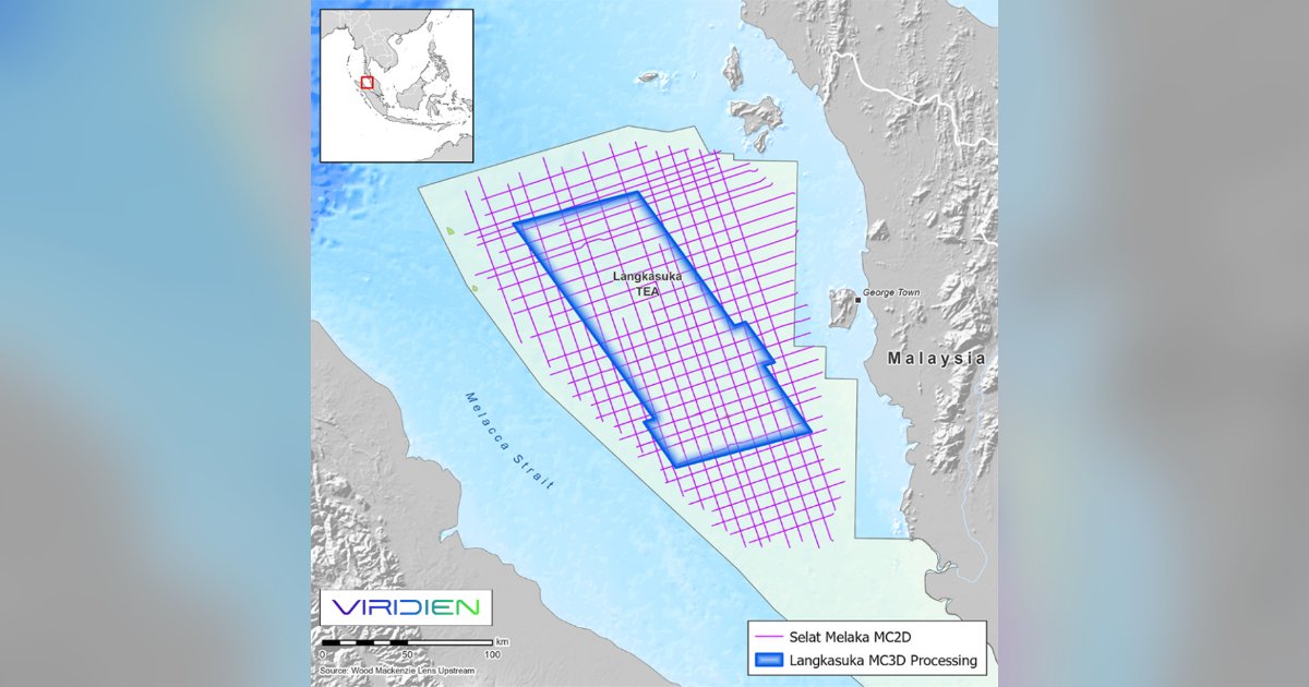
The Langkasuka MC3D dataset will integrate 12,300 sq km of streamer data and 3,300 sq km of OBN data acquired in the Malacca Strait, offshore West Peninsular Malaysia. Viridien will apply its advanced imaging technologies including time-lag full-waveform inversion (TLFWI) to the low-frequency TPS data to image the complex pre-Tertiary sequences in the region, where the presence of a previously unexplored Paleozoic sedimentary section has been demonstrated.
This project is supported by a high level of industry funding. Early results will be available in October 2026.
Dechun Lin, Head of Earth Data, Viridien, said: “The Langkasuka Basin continues to attract strong exploration interest. Building on the success of our Langkasuka basin study last year, the Langkasuka MC3D demonstrates Viridien’s commitment to leveraging its high-end imaging expertise to make proprietary-grade, drill-ready data available through a multi-client framework to help explorers unlock the potential of promising frontier basins.”