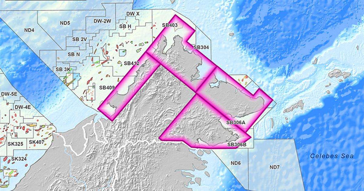
Covering approximately 60,000 km2, the IPSS will use Viridien’s multi-disciplinary geoscience expertise to integrate geological, geophysical, remote sensing, field, and laboratory data to assess basin-scale prospectivity and identify exploration opportunities. Deliverables will include play definition, sweet-spot identification, resource assessment, and ArcGIS-based digital geological mapping to support future exploration and potential seismic acquisition planning.
Dechun Lin, Head of Earth Data, Viridien, said: “Viridien has a long track record of leveraging its advanced geoscience and subsurface characterization expertise to support a better industry understanding of highly prospective regions. Through this IPSS project, we will apply those capabilities to onshore Sabah, where modern seismic data coverage remains limited, but the exploration potential is considered significant.”