Enhanced by climate change and an ongoing marine heatwave, El Niño is blocking nutrient upwelling, altering the foundation of the ocean food web. Monitoring the ongoing impact on marine life will be critical for managing fisheries and protecting endangered species.
MBARI’s advanced technologies continuously monitor the oceanographic and biological conditions in Monterey Bay. These instruments and the decades of data they have collected are invaluable as MBARI scientists work to understand how the historic 2026–2027 El Niño will affect marine life and ecosystems.
In October, MBARI technology recorded a deepening warm-water anomaly in Monterey Bay, indicating the arrival of El Niño in Central California. That anomaly has grown stronger, and MBARI scientists have now observed its ecological impact. Two MBARI technologies—a plankton microscope moored near the head of Monterey Bay’s submarine canyon and an autonomous robot conducting regular surveys of the north bay—have documented a sharp decrease in phytoplankton abundance and average carbon biomass.
“It was only a matter of time until we would observe the biological consequences of El Niño,” said Senior Scientist Francisco Chavez, a biological oceanographer at MBARI. “MBARI and our partners in the CeNCOOS research collaboration have recorded a dramatic decrease in the microscopic organisms that form the base of the food web. It was like things fell off a cliff. Other marine life that depend on these plankton in some form or another will be severely impacted, but the full impact won’t become clear until the upcoming spring and summer.”
Changing Ocean Conditions
Temperatures in the surface waters in Monterey Bay and across the Northeastern Pacific have already been above average for most of the year due to the North Pacific Gyre Oscillation, also known as the “warm blob” and often described as a marine heatwave. However, El Niño, which strengthened the ongoing marine heatwave off Southern California, has pushed exceptionally warm water into Monterey Bay, blocking the upwelling of nutrients that phytoplankton depend on.
MBARI’s M1 mooring has continuously monitored oceanographic conditions at the heart of the bay for nearly 40 years. Over the past two weeks, MBARI researchers have logged record-breaking temperatures, most recently observing a new time-series high record of 19.22 degrees Celsius (66.6 degrees Fahrenheit) 60 meters (200 feet) underwater on November 12. The strong uptick in warming that started in October is consistent with the arrival of the El Niño-driven Kelvin wave at the California coast.
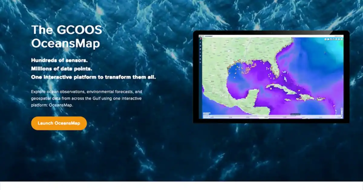
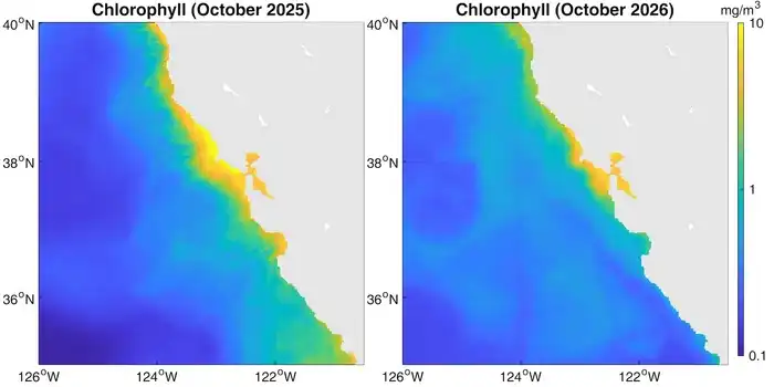
Remote sensing by satellites gives MBARI researchers a view of the bigger picture. Satellite data on sea surface temperature and chlorophyll—a photosynthetic pigment monitored as a measure of phytoplankton abundance and ocean productivity—reveal a startling change in ocean conditions offshore of Central California.
Senior Research Specialist Monique Messié leads MBARI’s Data Integration and Interdisciplinary Oceanography Team, using diverse datasets to understand ocean processes. Comparing satellite data recorded in October 2025 against data collected this October, Monterey Bay has become a blue desert.
“This really is a dramatic change,” said Messié. “The color scale in these plots is logarithmic, so we’re looking at a 10-fold decrease in phytoplankton biomass in some places, like off Big Sur. These are the lowest chlorophyll concentrations we’ve seen in this region since before 2000, according to satellite data.”
Monitoring Phytoplankton Populations
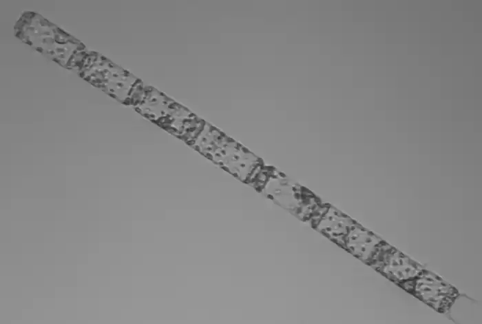
The Imaging FlowCytobot (IFCB) is a robotic microscope that captures high-resolution images of suspended particles, including plankton. An onboard computer uses image recognition processes and a machine learning model to estimate both the identity and the volume of the phytoplankton. Developed by Woods Hole Oceanographic Institution and manufactured by McLane Labs, this system allows researchers to study ocean productivity and detect harmful algal blooms.
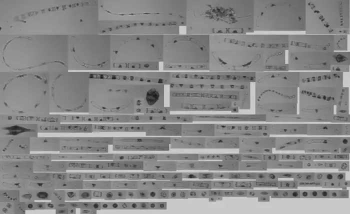
In 2021, MBARI engineers installed an IFCB on the institute’s wave energy conversion (WEC) buoy, located near the head of Monterey Canyon. MBARI shares these hourly datasets via the Central and Northern California Ocean Observing System (CeNCOOS), a research collaboration hosted at MBARI. This instrument is part of a statewide network of IFCBs that enables close monitoring of plankton populations, facilitating early detection of ecosystem changes like harmful algal blooms and streamlining access to information for decision-making.
“The IFCB complements the other suite of instrumentation MBARI has deployed across Monterey Bay, giving us a near-real-time picture of how the phytoplankton communities are shifting and reorganizing in the presence of El Niño,” said CeNCOOS Research Specialist Patrick Daniel.
“Our increased investments in technology to observe both the biology of marine life and the complex web of ecosystem changes are proving very capable in capturing and sharing information on the dramatic shifts in ocean health caused by El Niño,” added CeNCOOS Director Henry Ruhl.
Plummeting Productivity Near Shore
The coastal waters near shore, especially at the head of Monterey Bay’s deep submarine canyon, are typically very productive. Here, cool, nutrient-rich water rises to the surface and fuels the blooms of phytoplankton that drive the bay’s food web.
The current influx of warm water has pushed the thermocline deeper, blocking coastal upwelling. Without nutrients from deeper water, plankton populations have dropped dramatically.
Over a three-day period in early October, the IFCB cameras reported a significant decrease in phytoplankton abundance. Diatoms—tiny single-celled algae with glass skeletons—typically make up a large portion of Monterey Bay’s phytoplankton population, but their numbers dropped significantly on October 4 and have been largely absent beginning October 8. The total carbon biomass, a metric of ocean productivity, has continued to decline. These changes correlate with the deep warming recorded at MBARI’s M1 mooring beginning in October.

Upwelling, Interrupted
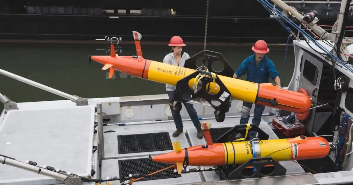
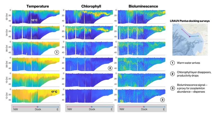
This change in ocean productivity was corroborated by data from routine surveys with MBARI’s long-range autonomous underwater vehicle (LRAUV) Pontus in the north bay.
An autonomous robot conducts regular surveys to monitor upwelling conditions, recharging every day at a solar docking station offshore of Santa Cruz, California. Sensors on the LRAUV monitor basic environmental parameters, like temperature and salinity. Specialized instrument payloads allow the vehicle to measure bulk phytoplankton properties. Fluorescence provides a measure of chlorophyll and phytoplankton productivity, while bioluminescence is used as a proxy for dinoflagellate and zooplankton populations.
Beginning on October 8, sensors on Pontus recorded warmer temperatures near the docking station. Soon after, the vehicle recorded a drop in chlorophyll, then a drop in bioluminescence—both signs that the foundation of Monterey Bay’s productive food web had collapsed.
Cascading Impacts
Plankton are the foundation of the ocean food web, providing food for krill and anchovies, who feed whales, commercially important fishes, and countless other pelagic predators. The sharp decline in plankton abundance will no doubt have cascading effects across Monterey Bay’s ecosystems.
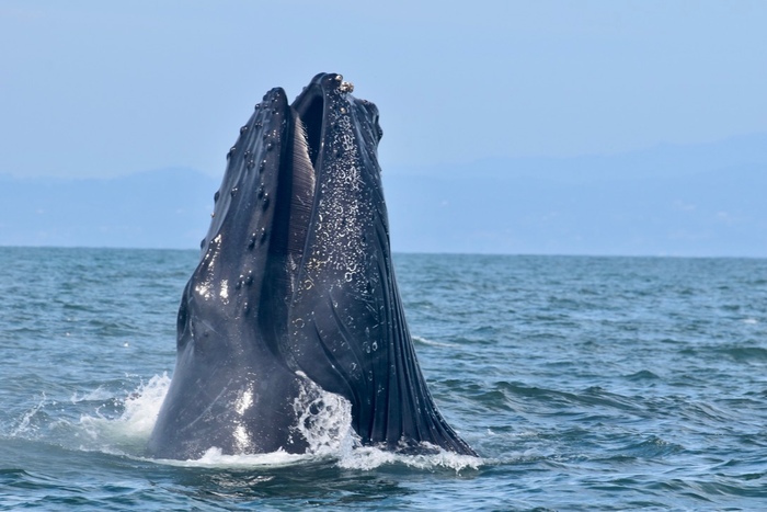
Already, these data give context to anecdotal observations reported across Monterey Bay. The dramatic decrease in plankton was observed firsthand by divers who were servicing MBARI’s WEC buoy on October 26 and noted the clearest waters they had ever seen since the buoy was first deployed. Local whale-watching ships have noted the absence of humpback whales, while local beachgoers have observed large numbers of malnourished and dead seabirds.
MBARI’s innovative technologies are allowing scientists to see the many, diverse impacts of El Niño on marine ecosystems that are otherwise challenging to observe. MBARI is putting additional observing systems in place to document further ecosystem perturbations caused by El Niño. Through the CeNCOOS collaboration, MBARI makes that data publicly available, so resource managers and policymakers have access to the strongest science when making decisions about the ocean during this historic El Niño event.
MBARI’s research on El Niño is made possible thanks to the longtime support of the David and Lucile Packard Foundation.
Access current and archived oceanographic data from MBARI’s ocean monitoring systems via the California Ocean Observing Systems El Niño dashboard and the statewide California Ocean Observing Systems Data Portal.