Aligned with European strategic objectives on technological sovereignty, resilience, and autonomy, the project is funded by ESA. It is carried out by a highly technological consortium led by Inster-Grupo Oesía, with the participation of UAV Navigation-Grupo Oesía, CTTC, and SICWAVE, and supports the development of dual-use navigation solutions based on non-GNSS signals, strengthening Europe’s ability to operate safely and effectively in contested environments.
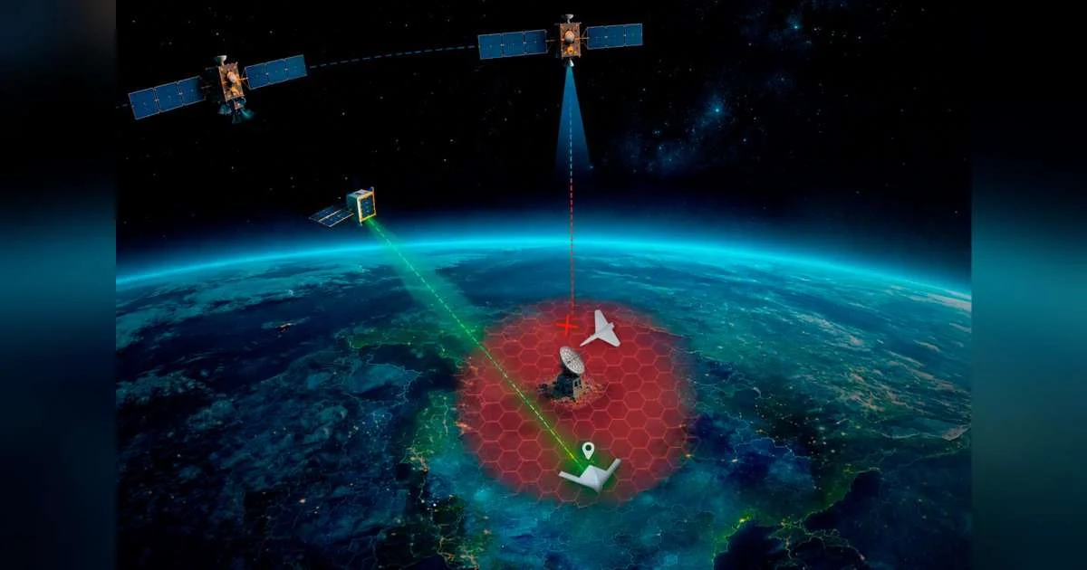
The project proposes the development of an advanced and integrated navigation system for UAS, leveraging non-cooperative signals—this is, signals not designed or intended to provide positioning or navigation services—from LEO communication satellites, particularly in Ka-band, to generate robust Positioning and Navigation (PNT) observables. These new observables are designed to complement and enhance traditional navigation sources, especially in scenarios where Global Navigation Satellite System (GNSS) signals are degraded, denied, jammed, or spoofed.
UAV Navigation-Grupo Oesía’s core contribution to the project focuses on the integration of LEO-derived PNT observables into its high-performance UAV autopilot. The autopilot’s navigation algorithms will perform multi-sensor data fusion, integrating positioning information derived from LEO communication signals with inertial measurements, air data, GNSS (when available), and advanced modalities such as vision-based navigation to ensure robust and resilient state estimation. This multi-sensor fusion approach is designed to ensure robust and accurate navigation performance even in GNSS-contested scenarios, maintaining mission continuity and operational safety.
This initiative reinforces UAV Navigation-Grupo Oesía’s long-term commitment to continuously exploring new alternatives for robust, reliable, and precise guidance, navigation, and control in increasingly challenging operational environments. As UAS operations expand into Beyond Line-of-Sight (BLOS) missions and contested airspace, resilient navigation capabilities are becoming mission-critical, particularly for defense, security, and Intelligence, Surveillance and Reconnaissance (ISR) applications.
A key innovation of the project is the extraction of position estimates from multibeam, electronically steered antennas and their integration as new observables within the UAV’s navigation filter. The use of high-directivity antennas, required for wideband communication with emerging LEO constellations such as IRIS² or similar systems, inherently enhances robustness against jamming and spoofing when compared to conventional omnidirectional GNSS antennas. The project will validate this approach in a flight-representative environment, demonstrating its feasibility and performance under realistic operational conditions.