As California policymakers weigh how to advance offshore wind energy in some of the state’s most productive waters without harming marine life, innovative MBARI technologies offer a solution for comprehensive ecosystem monitoring.
On an early October morning, as MBARI’s research vessel Paragon left Moss Landing with three robots loaded on its deck, Monterey Bay was showing off.
Anchovies packed the head of the submarine canyon in a dense school covering several square kilometers. Humpback whales lunged through the school, feeding alongside sea lions and long-beaked common dolphins, while flocks of seabirds worked the bait from above.
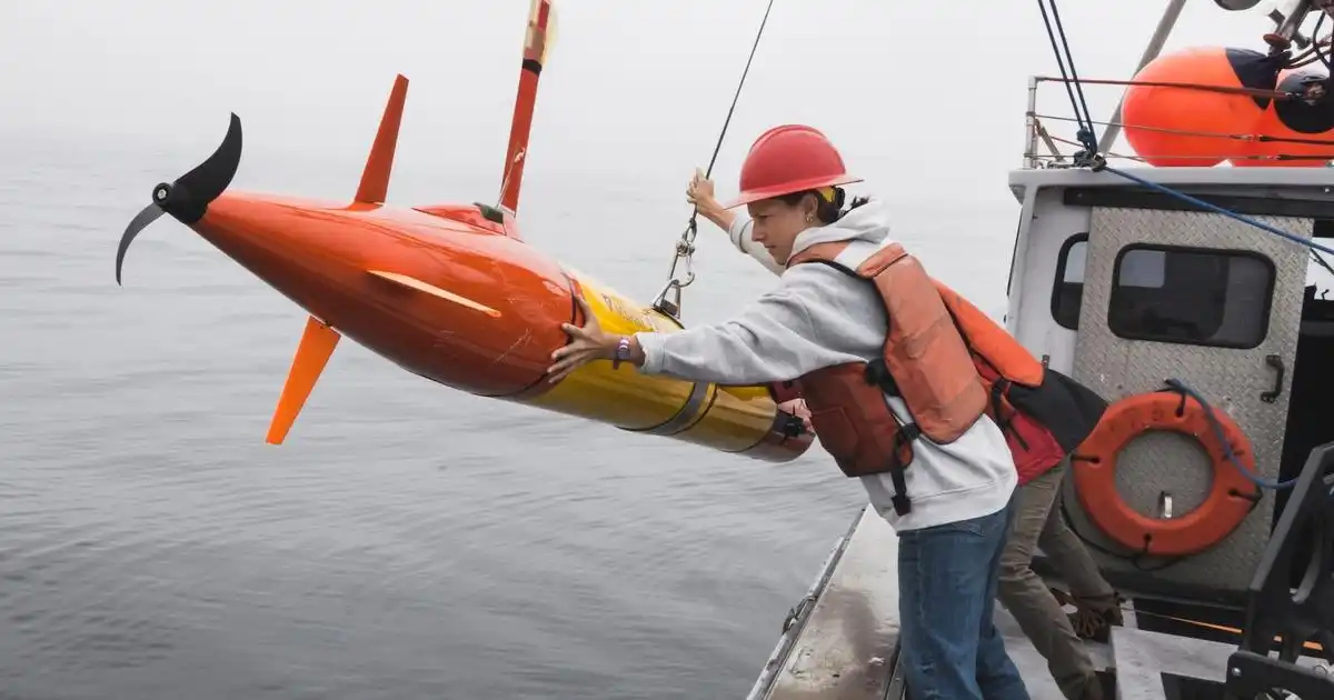
Out on the deep blue waters of the outer bay, MBARI engineers got to work deploying three underwater robots equipped with advanced sensors and software. These state-of-the-art vehicles would spend two weeks at sea gathering comprehensive data about marine life and ecosystems.
MBARI technology is transforming how scientists monitor ocean health. Autonomous robots enable real-time, persistent observation of marine ecosystems. This deployment in early October was part of a field demonstration MBARI conducted with the National Offshore Wind Research and Development Consortium (NOWRDC) that points to a revolutionary new way of monitoring ocean environments.
“Decades of MBARI engineering innovation have helped advance the science of environmental monitoring, providing tools to assess the current and future state of the ocean. Our collaboration with NOWRDC illustrates how this advanced technology can also be used to revolutionize how resource managers monitor marine life and ecosystems and contribute data for regulatory decision-making to ensure the safe and sustainable use of ocean resources,” said MBARI Senior Scientist Chris Scholin, who led the NOWRDC field demonstration.
The Challenge
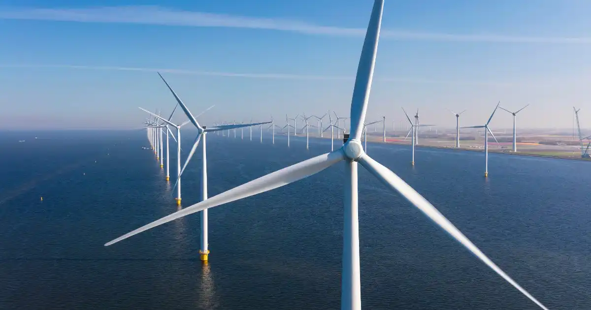
California has made offshore wind a pillar of its plan to decarbonize the grid. The state has identified deep-water lease areas to support arrays of floating turbines, however, these are located in some of the most productive waters along the coast. As state policymakers draft the rules that will govern how those installations are permitted and monitored, many questions about the environmental impact of offshore wind farms remain.
Responsible siting, permitting, and operations depend on understanding how ocean conditions and marine life change over time. Historically, understanding the complex web of ecological interactions in a marine community has required sending a ship and crew of researchers to conduct a detailed scientific survey. But the areas cited for wind energy development in California are frequently rough and relatively far from ports. Conducting routine assessments will require very capable vessels and crew to access these remote waters. Ship-based surveys also require substantial resources, and a crewed vessel can only be in one place at a time, limiting surveys over time and the area covered.
NOWRDC is a non-profit organization that connects key stakeholders in offshore wind energy across the US, including technology innovators, researchers, industry, and policymakers. NOWRDC funds strategic research projects to address barriers and challenges to the development of offshore wind energy, such as routine site monitoring.
Two decades of MBARI engineering innovation offered a solution to the challenge of environmental monitoring of offshore wind farms: autonomous underwater robots.
A Platform and a Process

The MBARI long-range autonomous underwater vehicle (LRAUV) is a versatile platform for ocean science. These vehicles support industry-standard instrumentation for basic environmental characterizations, as well as custom-designed payloads that leverage MBARI’s expertise in marine technology and engineering innovation to enable more sophisticated observations necessary for comprehensive ecosystem assessments.
The LRAUV is a proven platform for ocean exploration and science. After more than a decade of development, the LRAUV has become more than a vehicle—it is a tech ecosystem capable of supporting a variety of science missions. From observing pelagic predators to sampling environmental DNA (eDNA), the LRAUV is an ideal tool to meet the growing demand for scalable technologies to monitor the ocean.
MBARI’s proposal to NOWRDC was less about developing a new product, but rather a process. First, the team proposed a field demonstration with MBARI’s LRAUVs to show what a coordinated fleet of ocean robots can observe. With that as background, the team would engage an advisory board comprised of state, federal, and industry representatives to design a future field program to gather data most critical to informing future decision-making about the utility of using uncrewed robotic systems to provide required observations as supplements, or potentially replacements, for what otherwise would rest on routine crewed ship surveys.
Three Questions, Seven Robots
MBARI researchers identified three questions to answer during the demonstration:
- How does the ocean’s baseline productivity change over time in a rich coastal upwelling system like Monterey Bay?
- How do predators and prey, including endangered whales and commercially important fishes, move through an area and interact?
- What are the underlying ocean conditions, like ocean chemistry, that drive these biological observations?
They matched each question to a combination of vehicles and sensors and put them in the water.
The demonstration ran in two phases. From August 3–13, three vehicles worked a survey circle near the head of Monterey Bay’s submarine canyon: the Wave Glider Hansen, an autonomous surface vessel, mapped the water column with echosounders, while two LRAUVs, Makai and Brizo, imaged animals, collected eDNA, and logged acoustic data. This exploratory phase enabled the team to test and refine methodologies.
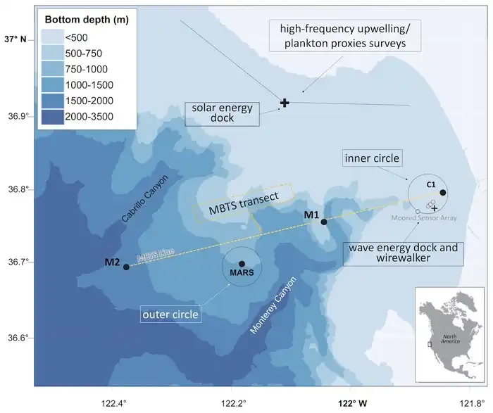
Then, from September 21 to October 15, MBARI deployed six LRAUVs in stages across the north bay and two survey circles, one at the canyon head and the other 32 kilometers (20 miles) offshore at MBARI’s MARS cabled observatory. Again, the Wave Glider Hansen conducted complementary echosounder surveys near the canyon head.
The team chose the two sites for contrast. The canyon head is typically a cold, chlorophyll-rich, productive zone. By chance, the MARS site on the day of deployment sat at the convergence of an offshore eddy drifting into the mouth of the bay with a warm tongue of water moving up from the south—the type of front where currents and contrasting water masses concentrate plankton, prey, and the animals that hunt them.
The team also added what a long-term monitoring program would need most: repeatable survey lines that mirrored MBARI’s longstanding Monterey Bay time series, and the ability to recharge the LRAUVs at sea.
Three Ways to Survey Marine Life with Autonomous Robots
Cameras. Planktivore, an underwater microscope, photographs tiny plankton as the vehicle passes through them. Piscivore, an AI-enabled camera system, images ocean predators, like sharks, fishes, seabirds, and marine mammals.
Sound. Echosounders send pulses into the water and read the echoes to map where the biological layers are. A hydrophone listens passively to everything from whale calls to ship noise.
DNA. The Environmental Sample Processor filters seawater and preserves the genetic “fingerprints” marine life leaves behind. Passive samplers on the vehicles collect eDNA continuously as they travel.
No single method sees everything. Six LRAUVs carrying distinct scientific payloads gathered data on different dimensions of ocean health. Together, they provide a comprehensive picture of Monterey Bay.
Innovation in Action
In the north bay, LRAUV Pontus carried a bioluminescence sensor alongside its standard oceanographic instruments and used machine learning to predict plankton community composition based on its measurements.
Twice during the second phase of the demonstration, a pair of LRAUVs ran a transect line from shore and back that approximated the size and scale of a wind energy area.
Ahi carried Planktivore, an underwater microscope that photographs the plankton it passes through rather than inferring who is there. Daphne carried the Sipper, a payload that draws small water samples through the water column for biogeochemical analysis back on shore. These data connect changes in the physical and chemical environment to the microscopic plants and animals at the base of the food web. Together, these vehicles gathered the same data a monthly research cruise would deliver.
From October 5–15, MBARI simultaneously leveraged all three sensing approaches in the same patch of water, first at the offshore MARS site and then at the canyon head.
Echosounders aboard the LRAUV Aku used acoustic “fingerprinting” to map the biological layers of marine life. Piscivore, an AI-enabled camera system on the LRAUV Makai, imaged elusive fishes, birds, and marine mammals that steer clear of large ships. Passive samplers on both vehicles continuously soaked up eDNA—the trace genetic material shed by marine life—as they traveled, while the Environmental Sample Processor (ESP) onboard Brizo filtered seawater and preserved eDNA as a third, independent census. During the evening, Brizo drifted in “Zen” mode, its hydrophone recording the soundscape of a stretch of ocean, from the low bellows of whales to the clicks of dolphins to the hum of distant ship traffic.
Towards a Persistent Presence
Monitoring ocean processes and ecosystems requires sustained operations. MBARI technologies are up for the challenge.
Over approximately 2,000 operating hours, the fleet of LRAUVs traveled more than 4,000 kilometers (almost 2,500 miles)—roughly the distance from California to Hawaii—and collected more than 100 eDNA samples.
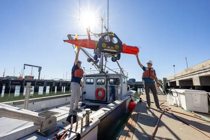
Power is a limiting factor for autonomous robots, requiring recovery of vehicles for charging, especially when operating high-power sensors. MBARI engineers have developed a solar-powered docking station that can recharge the LRAUV at sea. Between surveys in the north bay, LRAUV Pontus returned to this docking station to recharge and transfer data 20 times, enabling the vehicle to collect a trove of data for weeks without coming back to shore.
The NOWRDC field demonstration also marked the first docking of an LRAUV with MBARI’s wave energy conversion (WEC) buoy. By harvesting energy from wave motion, this system generates approximately 10 times more power than its solar counterpart. LRAUV Brizo successfully docked with the WEC buoy twice during the field demonstration.
What Happens Next
MBARI’s field demonstration this fall showed that uncrewed systems can be an efficient and cost-effective tool for monitoring an offshore area. Over the course of three months of fieldwork, MBARI scientists, engineers, and marine operations crew learned what works operationally, from the sensors to the docks to the way data flows back to shore. Now, the team is analyzing the trove of data and samples.
MBARI will report to the project’s primary sponsor, the California Energy Commission, this coming year. A meeting planned for early 2027 will bring the NOWRDC advisory board together to review the demonstration results so that, as they move forward with establishing regulatory and permitting guidance, opportunities for using uncrewed systems to meet monitoring needs can be included.
A hub of discovery and innovation, MBARI develops tools that help scientists better understand the ocean. By making its technologies, scientific expertise, and data broadly available, MBARI supports informed decision-making about marine life, ecosystems, and resources.
The NOWRDC demonstration is just the latest example of MBARI technology enabling research on a changing planet. MBARI’s partnerships with government agencies and academic peers have previously deployed LRAUVs to monitor harmful algal blooms in Lake Erie and reveal daily rhythms of microbial activity that drive ocean productivity. The technology ecosystem tested for environmental monitoring of offshore wind energy development can be applied across a wide range of ocean uses, including managing fisheries, monitoring marine protected areas, and advancing climate research.
“The technology works the same way whether you’re doing basic research or solving a practical problem,” explained Scholin. “Our job is to build the tools, show that they work, and share the technology, expertise, and data widely so everyone at the table is looking at the same information. We care that the people making decisions are using the best science available.”
This work was made possible by the generous support of the David and Lucile Packard Foundation. Additional support was provided by the National Offshore Wind Research and Development Consortium (NOWRDC), the California Energy Commission (CEC), the New York State Energy Research and Development Authority (NYSERDA), and the Massachusetts Clean Energy Center (MA CEC).